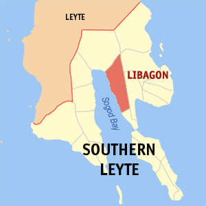
Libagon
Appearance

Libagon is a 4th class municipality in the province of Southern Leyte, Philippines.
Libagon the home of Southern Leyte frontier mountain to the world the Mt. Patag Daku. Libagon is known of of its Spanish style municipal building. It is said to beEastern Visayas most hispanic town. There are some spots that the Libagonians can be proud of the Biasong Spring,Pangi Black Sand Beach, Endriga Beach Resort,Uwan-Uwanan Waterfalls, Ruins of the Old Pantalan (seaport) and the old building of the Libagon Academy Foundation, Inc. high School. Libagon is Southern Leyte swimming capital and one of Eastern Visayas best in swimming.According to the 2007 census, it has a population of 14,238
Barangays
Libagon is politically subdivided into 14 barangays.
- Biasong
- Bogasong
- Cawayan
- Gakat
- Jubas (Pob.)
- Magkasag
- Mayuga
- Nahaong
- Nahulid
- Otikon
- Pangi
- Punta
- Talisay (Pob.)
- Tigbao
