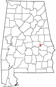
Tallassee, Alabama
Tallassee is a city located in Elmore County, Alabama. As of the 2000 census, the population of the city is 4,934.
Geography

Tallassee is located at 32°32'22" North, 85°53'35" West (32.539402, -85.893061)1. According to the U.S. Census Bureau, the city has a total area of 26.3 km² (10.2 mi²). 24.9 km² (9.6 mi²) of it is land and 1.4 km² (0.5 mi²) of it is water. The total area is 5.21% water.
Tallassee is located in the densely forested Emerald Mountains, a small southeasternly chain of the Lower Appalachians and is bordered by two major rivers: The Coosa River to the west, and the Tallapoosa in the east. The Tallapoosa River also serves as the dividing line between two counties and towns: the City of Tallassee (Elmore County) and East Tallassee (Tallapoosa County).
Demographics
As of the census2 of 2000, there are 4,934 people, 2,067 households, and 1,343 families residing in the city. The population density is 197.8/km² (512.2/mi²). There are 2,367 housing units at an average density of 94.9/km² (245.7/mi²). The racial makeup of the city is 80.34% White, 17.61% Black or African American, 0.34% Native American, 0.30% Asian, 0.02% Pacific Islander, 0.18% from other races, and 1.20% from two or more races. 1.07% of the population are Hispanic or Latino of any race.
There are 2,067 households out of which 28.3% have children under the age of 18 living with them, 45.0% are married couples living together, 16.0% have a female householder with no husband present, and 35.0% are non-families. 32.4% of all households are made up of individuals and 18.4% have someone living alone who is 65 years of age or older. The average household size is 2.33 and the average family size is 2.94.
In the city the population is spread out with 24.5% under the age of 18, 7.7% from 18 to 24, 24.3% from 25 to 44, 21.7% from 45 to 64, and 21.7% who are 65 years of age or older. The median age is 40 years. For every 100 females there are 83.7 males. For every 100 females age 18 and over, there are 78.4 males.
The median income for a household in the city is $23,946, and the median income for a family is $32,015. Males have a median income of $27,313 versus $22,993 for females. The per capita income for the city is $14,859. 22.8% of the population and 16.9% of families are below the poverty line. Out of the total people living in poverty, 31.5% are under the age of 18 and 19.9% are 65 or older.
The Creek Wars and Indian Removal
Some historians and archeologists posit that in the late 18th and early 19th centuries this verdant area was the second largest permanent Indian settlement in North America. The Creek Indian ancestors in this area were Mississipian Mound Builders who relied greatly on fishing and riverway trading (c.f. Moundville, Tuscaloosa).
The Tallassee area was also the home of the last great Creek capitol city, Tuckabatchie as well as the Great Council Tree which was destroyed in 1929. After a visit by the Shawnee hero, Tecumseh, who urged the Creek to join the Great Confederation of First Nations, the Creek split into two distinct factions; the White Stick Creek who sided with the federal government and the Red Stick Creek who opposed the settlement of their land by whites -See also Baton Rouge, Indian Territory and Oklahoma.
The Creek Wars were marked by mutual raids, scalpings and civilian massacres by both sides. The war reached its bloody climax at the Battle of Horseshoe Bend on the banks of the Tallapoosa River when a coalition of federal troops, Alabama militia White Stick Creek and bitter rival Cherokees crushed the outnumbered and outgunned Red Sticks. Then-General Andrew Jackson counted Horsehoe Bend among his politically strategic victories and it helped pave the road for his future policies of Indian Removal. See also Trail of Tears, Cherokee, Choctaw, Chickasaw, Catawba, Seminole. The aftermath of the Creek Wars resulted in the exodus of many Creeks to Indian Territory, while some went into hiding with other resistant Indians in the Southeast (c.f. Seminole, Cherokee, Trail of Tears, Osceola). The ancient city of Talisi and neighboring Wetumpka are still home to the remnants of the federally-recognized Poarch Band of Creek Indians.
