
Päijät-Häme
Päijänne Tavastia
Päijät-Hämeen maakunta Päijänne Tavastlands landskap | |
|---|---|
 Coat of arms | |
 Päijänne Tavastia on a map of Finland | |
| Country | Finland |
| Historical province | Tavastia |
| Area | |
| • Total | 6,256.66 km2 (2,415.71 sq mi) |
| Population (2009) | |
| • Total | 199,700 |
| • Density | 32/km2 (83/sq mi) |
| NUTS | 185 |
| Regional bird | White-backed Woodpecker (Dendrocopos leucotos) |
| Regional fish | Carp bream (Abramis brama) |
| Regional flower | Cornflower (Centaurea cyanus) |
| Website | paijat-hame.fi |
Päijänne Tavastia (Finnish: Päijät-Häme; Swedish: Päijänne Tavastland) is a region in Southern Finland south of the lake Päijänne. It borders the regions Uusimaa, Tavastia Proper, Pirkanmaa, Central Finland, Southern Savonia and Kymenlaakso.
Historical provinces
For history, geography and culture see: Tavastia
Municipalities
There are 11 municipalities in Päijänne Tavastia. Cities and towns are marked in bold.
|
Lahti Sub-region: |
Former Heinola Sub-region: The municipal council of Iitti has decided to join Päijänne Tavastia and leave Kymenlaakso in January 2013 due to the result of a November 2011 referendum. |
Heraldry
Blazon: Azure, a mermaid and in dexter chief a cuckoo close Or.
In laymen's terms: The coat of arms sports a depiction of the ancient water goddess Vellamo as a mermaid, with a cuckoo to represent the influence of the numerous post-World War II Karelian refugees in Lahti and the surrounding regions.
Politics
Results of the Finnish parliamentary election, 2011 in Päijänne Tavastia:
- National Coalition Party 23.2%
- True Finns 22.7%
- Social Democratic Party 22.0%
- Centre Party 11.6%
- Christian Democrats 7.5%
- Left Alliance 6.1%
- Green League 4.5%
See also
Gallery
-
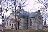
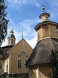
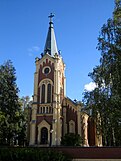
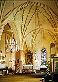 Medieval church in Hollola
 -
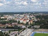 A view of Lahti centre
 -
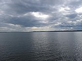
 Lake Päijänne in Sysmä
 -
 Heinola town centre
 -
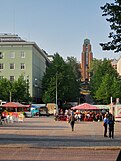 Lahti Market Place with the City Hall by Eliel Saarinen in the background
 -
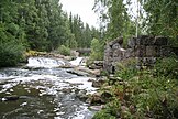 Virenoja Rapids and ruins of an old mill, Orimattila
 -
 Hartola Church
 -
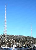 The radio masts in Lahti, symbols for the city
 -
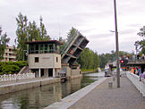 Vääksy Canal, Asikkala
 -
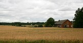 Rural landscape in Orimattila
 -
 Nastola Church
 -
 Rural landscape in Kärkölä
 -
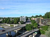
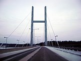 A bridge in Heinola
 -
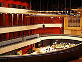 The celebrated Sibelius Hall is the heart of Lahti's cultural life
 -
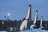 Ski jumping hills in Lahti; also an venue for Ski Jumping WC
 -
Church of the Cross, Lahti designed by Alvar Aalto
-
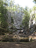 A rock cleft in Hollola
 -
 The Gothic Revival church in Kärkölä
 -
 Lake Vesijärvi in Asikkala
 -
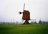 A windmill in Hartola
 -
 A typical traditional Tavastian village view, Orimattila
 -
 National romantic municipal house in Hollola
 -
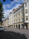 Architecture in Lahti
 -
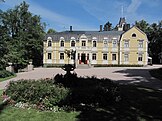 Pyhäniemi Manor, Hollola
 -
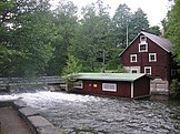 An old mill at River Vääksynjoki, Asikkala


External links
| Regions |  | |
|---|---|---|
| Former regions | ||