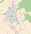
File:Filakovo-Fülek OSM map.png
Appearance

Size of this preview: 554 × 600 pixels. Other resolutions: 222 × 240 pixels | 443 × 480 pixels | 848 × 918 pixels.
Original file (848 × 918 pixels, file size: 370 KB, MIME type: image/png)
File history
Click on a date/time to view the file as it appeared at that time.
| Date/Time | Thumbnail | Dimensions | User | Comment | |
|---|---|---|---|---|---|
| current | 13:51, 4 January 2017 |  | 848 × 918 (370 KB) | Füleki | User created page with UploadWizard |
File usage
No pages on the English Wikipedia use this file (pages on other projects are not listed).
Global file usage
The following other wikis use this file:
- Usage on hu.wikipedia.org
- Urbánka
- Füleki vár
- Fülek vasútállomás
- Füleki Városi Honismereti Múzeum
- Sablon:Pozíciós térkép Fülek
- Füleki köztemető
- Füleki evangélikus temető
- Berchtold-kastély (Fülek)
- Koháry-kúria (Fülek)
- Római katolikus templom (Fülek)
- Szerkesztő:Füleki/próbalap
- Füleki buszpályaudvar
- Paprét (Fülek)
- Szentfali
- Városháza (Fülek)
- Református templom (Fülek)
- Füleki Városi Könyvtár
- Mocsáry Lajos Alapiskola
- Iskola Utcai Szlovák Tannyelvű Alapiskola
- Usage on www.wikidata.org


