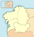
File:Galicia-loc.svg
Appearance

Size of this PNG preview of this SVG file: 512 × 553 pixels. Other resolutions: 222 × 240 pixels | 444 × 480 pixels | 711 × 768 pixels | 948 × 1,024 pixels | 1,896 × 2,048 pixels.
Original file (SVG file, nominally 512 × 553 pixels, file size: 602 KB)
File history
Click on a date/time to view the file as it appeared at that time.
| Date/Time | Thumbnail | Dimensions | User | Comment | |
|---|---|---|---|---|---|
| current | 14:48, 4 November 2023 |  | 512 × 553 (602 KB) | Lojwe | Removing frame |
| 19:18, 20 May 2010 |  | 512 × 553 (603 KB) | Miguillen | == {{int:filedesc}} == {{Information |Description={{en|Location map of Galicia (Spain)}} Equirectangular projection, N/S stretching 130 %. Geographic limits of the map: * N: 44.163361° N * S: 41.539398° N * W: 9.568769° O * E: 6. |
File usage
No pages on the English Wikipedia use this file (pages on other projects are not listed).
Global file usage
The following other wikis use this file:
- Usage on an.wikipedia.org
- Santiago de Compostela
- Vigo
- A Coruña
- A Pobra do Brollón
- Bóveda
- Monforte de Lemos
- Sober
- Pantón
- O Saviñao
- Abadín
- Begonte
- Castro de Rei
- Cospeito
- Guitiriz
- Muras
- A Pastoriza
- Vilalba
- Xermade
- Alfoz (Lugo)
- Burela
- Foz (Lugo)
- Lourenzá
- Mondoñedo
- O Valadouro
- Antas de Ulla
- Monterroso
- Palas de Rei
- Baleira
- A Fonsagrada
- Negueira de Muñiz
- Baralla (Lugo)
- Becerreá
- Cervantes
- Navia de Suarna
- As Nogais
- Pedrafita do Cebreiro
- Barreiros
- A Pontenova
- Ribadeo
- Trabada
- Carballedo
- Chantada
- Taboada
- Castroverde
- O Corgo
- Friol
- Guntín
- Lugo
- Outeiro de Rei
- Portomarín
View more global usage of this file.
