Horta of Valencia
Appearance
Horta of Valencia | |
|---|---|
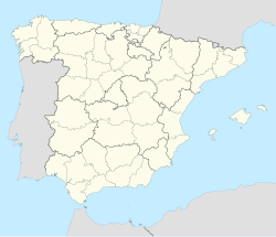
 Huerta de Valencia on map of Valencian Community | |
| Coordinates: 39°28′N 0°22′W / 39.467°N 0.367°W | |
| Country | |
| Autonomous community | |
| Province | Valencia |
| City and comarcas | Valencia, Horta Nord, Horta Sud, Horta Oest |
| Area | |
| • Total | 631.9 km2 (244.0 sq mi) |
| Population (2019) | |
| • Total | 1,567,118 |
| • Density | 2,480/km2 (6,400/sq mi) |
| Demonym | Valencian |

The Horta of Valencia (Valencian: Horta de València; Spanish: Huerta de Valencia) is a historical comarca of the Valencian Community, in Spain. Currently, Horta of Valencia is the common name and refers to the urban area / metropolis covered Valencia (commune) and three neighboring comarcas: Horta Nord, Horta Sud, Horta Oest.
Administrative division
[edit]| Division of the metropolis Huerta de Valencia | |||
|---|---|---|---|
| Comarca | Population (2019)[1] | Area | Density |
| Ciudad de Valencia (municipio) | 801 545 | 134,7 km² | 5853 /km² |
| Huerta Oeste (western zone) | 359 337 | 187,6 km² | 1982 /km² |
| Huerta Norte (north zone) | 228 424 | 140,4 km² | 1627 /km² |
| Huerta Sur (south zone) | 178 118 | 166,2 km² | 1071 /km² |
| Total: | 1 567 118 | 631,9 km² | 2480 /km² |
Origin
[edit]Originally Valencia was founded as a base for Roman campaigns into Spain.[citation needed]
Traditional Arab irrigation systems were built in l'Horta de Valencia during the Al-Andalus period; the historical irrigation system at l'Horta de València was named a Globally Important Agricultural Heritage Site in 2019.[2]
References
[edit]- ^ INEbase. Alteraciones de los municipios
- ^ "Historical Waterscape of l'Horta de València". FAO.org. Retrieved 2022-10-07.
Sources
[edit]- Besó Ros, Adrià (2016). Horts de tarongers. La formació del verger valencià. Valencia: Institució Alfons el Magnànim. p. 453. ISBN 978-84-7822-686-3.
- Sala Giner, Daniel. 2007. La milenaria Acequia de Mislata. Javier Boronat (ed.). Valencia. 183 pages.
- L'Horta de València: estudis comarcals de la província de València (in Catalan). PUV. 2018. ISBN 9788491331742.
- Esquilache, Ferran (2018). Els constructors de l'Horta de València : origen, evolució i estructura social d'una gran horta andalusina entre els segles VIII i XIII. PUV. ISBN 9788491343721.


