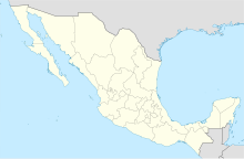
Nogales International Airport (Mexico)
Nogales International Airport Aeropuerto Internacional de Nogales | |||||||||||
|---|---|---|---|---|---|---|---|---|---|---|---|
| Summary | |||||||||||
| Airport type | Public | ||||||||||
| Operator | Grupo Olmeca-Maya-Mexica | ||||||||||
| Serves | Nogales, Sonora, Mexico | ||||||||||
| Time zone | MST (UTC−07:00) | ||||||||||
| Elevation AMSL | 1,222 m / 4,009 ft | ||||||||||
| Coordinates | 31°13′34″N 110°58′33″W / 31.22611°N 110.97583°W | ||||||||||
| Website | grupoolmecamayamexica | ||||||||||
| Map | |||||||||||
 | |||||||||||
| Runways | |||||||||||
| |||||||||||
| Statistics (2023) | |||||||||||
| |||||||||||
Source: Olmeca-Maya-Mexica | |||||||||||
Nogales International Airport (Spanish: Aeropuerto Internacional de Nogales) (IATA: NOG, ICAO: MMNG) is an international airport located in Nogales, Sonora, Mexico, near the U.S.-Mexico border. It handles national and international air traffic for the city of Nogales, serving flight training and general aviation activities. The airport does not provide scheduled passenger public flights. The nearest airports serving commercial flights are Tucson International Airport, in Arizona, and Hermosillo International Airport, in Sonora.
The airport was under the operation of Aeropuertos y Servicios Auxiliares (ASA) from 1966 to 2023. It is currently operated by Grupo Olmeca-Maya-Mexica, a military-owned corporation. In 2021, the airport facilitated the transportation of 4,020 passengers, and in 2022, the number decreased to 2,136 passengers.[1]
The airport is situated at an elevation of 1,222 metres (4,009 ft) above mean sea level, covering an area of 108 hectares (270 acres). It features a single asphalt runway, designated as 16/34, measuring 1,800 by 30 metres (5,906 by 98 ft). The apron spans 4,543 square metres (48,900 sq ft), featuring one parking position for small aircraft and general aviation. Adjacent facilities include a small passenger terminal and several hangars.
Statistics
[edit]Passengers
[edit]Graphs are unavailable due to technical issues. Updates on reimplementing the Graph extension, which will be known as the Chart extension, can be found on Phabricator and on MediaWiki.org. |
See also
[edit]- List of the busiest airports in Mexico
- List of airports in Mexico
- List of airports by ICAO code: M
- List of busiest airports in North America
- List of the busiest airports in Latin America
- Transportation in Mexico
- Tourism in Mexico
- Grupo Olmeca-Maya-Mexica
- Tucson International Airport
- Hermosillo International Airport
References
[edit]- ^ "Estadística Operacional de los Aeropuertos de la Red ASA" (in Spanish). January 2023. Retrieved 15 January 2023.
External links
[edit]- Official Website
- Grupo Olmeca Maya Mexica
- Aeronautical chart and airport information for MMNG at SkyVector
- Current weather for MMNG at NOAA/NWS
- Accident history for NOG at Aviation Safety Network
- Nogales Airport information at Great Circle Mapper


