User:E. Brown/List of National Parks of the United States

National parks have been called “America’s Greatest Idea” in that they are a truly American concept that has resonated throughout the globe. On March 1, 1872, President Ulysses S. Grant signed into law what was called The Act of Dedication that set aside Yellowstone National Park as a "public park or pleasuring ground for the benefit and enjoyment of the people." It was the first federally protected parkland in the world created for the sole purpose of protecting its natural environment for future generations to enjoy. Now, most countries have parkland protected by the federal government.
In the United States, national parks are created by acts of Congress, unlike national monuments which can be created by executive order. The purpose of national parks are to federally and legally protect unique natural landscapes and fragile, diverse ecosystems from human encroachment.
As of October, 2009, there are 58 national parks in the US spread across 25 different states as well as the U.S. Virgin Islands and American Samoa. They are all administered by the National Park Service under the US Department of the Interior. The most recent was Great Sand Dunes National Park and Preserve in Colorado, established in 2004. Alaska and California are tied for the most with eight.
List of National Parks
[edit]| National Park Name | Photo | Location | Date Established | Area | Description |
|---|---|---|---|---|---|
| Acadia | 
|
Maine 44°21′N 68°14′W / 44.35°N 68.23°W |
February 26, 1919 | 47,748 acres (74.6 sq mi, 193.2 sq km) | Acadia is a section of rocky Maine coastline shaped by glaciers during the Last Ice Age. It’s known for its unique geology and scenic views. Parts of the shoreline are lined with sheer cliffs 50 feet high. Most of the park lies on Mount Desert Island, but also includes Isle au Haut and several other small islands as well as the Schoodic Peninsula. |
| National Park of American Samoa | 
|
American Samoa 14°17′42″S 170°42′00″W / 14.295°S 170.70°W |
October 31, 1988 | 10,520 acres - 7,970 land, 2,550 marine (16.4 sq mi/42.6 sq km) | American Samoa is famed for its striking natural beauty. The national park was established to protect the unique tropical and marine environment of the islands and the fragile ecosystems of the surrounding waters. The park, which is jointly managed by the local government and conservation groups, protects portions of three islands: Tutuila, Ofu and Ta’u. |
| Arches | 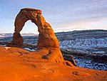
|
Utah 38°42′N 109°36′W / 38.70°N 109.6°W |
November 12, 1971 | 76,359 acres (119.3 sq mi, 309 sq km) | Arches National Park contains dozens of natural arches and other unique geological formations created by millions of years of erosion. Cracks form in the surface rock and over millennia of weathering, the elements can bore a hole in the exterior to form the arch. They are especially common in the soft sandstone of Utah’s Colorado Plateau. |
| Badlands | 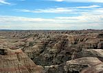
|
South Dakota 43°27′N 102°18′W / 43.45°N 102.30°W |
November 10, 1978 | 244,300 acres (381.7 sq mi, 988.6 sq km) | Badlands are a unique landscape of low escarpments caused by erosion in the surface rock. A large portion of the park is actually wilderness. The park is divided into three different units: the Sage Creek Unit or North Unit, the Stronghold Unit or South Unit and the Palmer Creek Unit. |
| Big Bend | 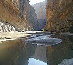
|
Texas 29°18′N 103°14′W / 29.30°N 103.23°W |
June 12, 1944 | 801,163 acres (1,251.8 sq mi, 3,242.2 sq km) | Big Bend NP encompasses the wilderness surrounding the Chisos Mountains in the Big Bend area of western Texas. It is an expanse of desert backcountry including steep canyons and jagged, rocky peaks. The term "Big Bend" refers to the bend in the Rio Grande as it turns northward. |
| Biscayne | 
|
Florida 25°28′N 80°16′W / 25.46°N 80.27°W |
June 28, 1980 | 172,924 acres (270.2 sq mi, 700 sq km) | Most of Biscayne NP is actually underwater. The parks purpose is to protect the fragile marine ecosystems of Biscayne Bay. The park’s boundaries also include part of the mainland waterfront, Elliott Key, Old Rhodes Key, Sands Key, Boca Chita Key and many smaller cays. Numerous shipwrecks also lie in the park’s waters. |
| Black Canyon of the Gunnison | 
|
Colorado 38°32′N 107°41′W / 38.54°N 107.68°W |
October 21, 1999 | 30,385 acres (47.5 sq mi, 123 sq km) | The sheer walls of the narrow Black Canyon of the Gunnison are made up of some of the oldest exposed rock in the world, dating back to the Precambrian. Mule deer and black bears are known to inhabit the park. |
| Bryce Canyon | 
|
Utah 37°36′N 112°11′W / 37.60°N 112.18°W |
September 15, 1928 | 35,835 (56 sq mi, 145 sq km) | Bryce Canyon is home to a myriad of strange geologic rock formations, notably fields of hoodoos, all carved out of the soft sandstone of Utah’s Colorado Plateau by millennia by erosion. The park’s most famous features are Thor’s Hammer and the Bryce Amphitheater. |
| Canyonlands | 
|
Utah 38°12′N 109°53′W / 38.20°N 109.89°W |
September 12, 1964 | 337,598 acres (527.5 sq mi, 1,366.2 sq km) | At the confluence of the Green and Colorado rivers is a sprawling landscape of deep gorges and peculiar geological formations known as the Canyonlands. The rivers divide the park into three sections, each one with its own unique features: the winding canyons of the Maze section, the sea of jagged spires in the Needles section and the high plateau of the Island in the Sky section. |
| Capitol Reef | 
|
Utah 38°15′N 111°13′W / 38.25°N 111.21°W |
December 18, 1971 | 241,904 acres (378 sq mi, 979 sq km) | The centerpiece of this park is Waterpocket Fold, an immense monocline that stretches for over 100 miles. It also contains many of the strange geological formations that are iconic of the Utah desert and its four other national parks. |
| Carlsbad Caverns | 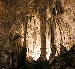
|
New Mexico 32°07′N 104°33′W / 32.12°N 104.55°W |
May 14, 1930 | 46,766 acres (73.1 sq mi, 189.2 sq km) | Dubbed “the Grand Canyon with a roof on it” by Will Rogers, Carlsbad Caverns is one of the most extensive cave systems in the southwestern United States. The caverns lie beneath the Guadalupe Mountains of west Texas and southeastern New Mexico and are noted for their particularly ornate features. |
| Channel Islands | 
|
California 34°00′N 119°56′W / 34°N 119.93°W |
March 5, 1980 | 249,354 acres (389.6 sq mi, 1,009.1 sq km) | California’s Channel Islands and the surrounding waters are home to a diverse array of wildlife, including many endangered species. The park was established to protect these fragile ecosystems. The islands are also noted for their spectacular vistas and are a popular destination for scuba divers. |
| Congaree | 
|
South Carolina 33°47′N 80°46′W / 33.79°N 80.77°W |
November 10, 2003 | 24,180 acres (37.8 sq mi, 98 sq km) | Often referred to as a swamp, Congaree is actually one of the largest tracts of old-growth forest in the United States. It is often described as a classic example of southern, old-growth hardwood forest, with Spanish moss dangling from the branches giving the place a haunting feel. UNESCO has recognized Congaree as an international biosphere reserve. |
| Crater Lake | 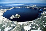
|
Oregon 42°56′N 122°07′W / 42.94°N 122.11°W |
May 22, 1902 | 183,224 acres (286.3 sq mi, 741.5 sq km) | Reknowned for its rich blue color, Crater Lake is the second-deepest lake in North America (Great Slave Lake in Canada is slightly deeper). The lake fills a volcanic caldera created by the collapse of Mount Mazama about 9,700 years ago following a major eruption. The lake is unique in that it has no tributaries or inflows. For this reason, it is some of the continent’s purest surface water. These traits are also responsible for the lake’s color. |
| Cuyahoga Valley | 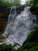
|
Ohio 41°16′N 81°34′W / 41.26°N 81.56°W |
October 11, 2000 | 33,000 acres (51.5 sq mi, 133.5 sq km) | Cuyahoga Valley NP is a tract of historic, backwoods forest of northeastern Ohio between Cleveland and Akron. Despite its proximity to urban areas, the park has a rural, backwoods feel to it. The area is steeped in history and lore and has many scenic areas, the most famous of which being Brandywine Falls. |
| Death Valley | 
|
California, Nevada 36°23′N 117°00′W / 36.39°N 117°W |
October 31, 1994 | 3.4 million acres (5,312.5 sq mi, 13,759 sq km) | Death Valley is the archetypal desert landscape. It is one of the harshest places on earth, with daytime temperatures that have topped 130˚F (54.4˚C). The park is home to Badwater Basin, the lowest point in the western hemisphere, and the famous Racetrack Valley. |
| Denali | 
|
Alaska 63°18′N 151°00′W / 63.30°N 151°W |
February 26, 1917 | 6,075,029 acres (9,492 sq mi, 24,585 sq km) | Denali NP contains several of the highest peaks in North America, including the highest; Mt. McKinley, also known by its Athabaskan name Denali, meaning “High One” It is also home to large populations of grizzly bear, elk and caribou. Denali, like the rest of Alaska’s national parks, is mostly wilderness. However, it is the state’s most well known and most visited park. |
| Dry Tortugas | 
|
Florida 24°38′N 82°55′W / 24.63°N 82.92°W |
October 26, 1992 | 64,700 acres – mostly marine (101 sq mi, 262 sq km) | The park protects the fragile marine ecosystem in the waters surrounding the Dry Tortugas and preserves some of the history of the islands. Historic Fort Jefferson sits on Garden Key, taking up most of the island. |
| Everglades | 
|
Florida 25°30′N 80°54′W / 25.50°N 80.90°W |
December 6, 1947 | 1,507,850 acres (2,356 sq mi, 6,102 sq km) | The Everglades are one of the most diverse ecosystems in the world. Many threatened and endangered species reside in the Everglades. The park was established to protect these fragile ecosystems. It is a UNESCO international biosphere reserve and World Heritage Site. |
| Gates of the Arctic | 
|
Alaska 67°48′N 153°12′W / 67.80°N 153.20°W |
December 2, 1980 | 8.5 million acres (13,281 sq mi, 34,398 sq km) | The idea behind the creation of Gates of the Arctic NP & Pres was to preserve a piece of Alaska’s arctic wilderness, untouched by the hand of man. No roads, no trails, just a few cabins and the raw wilderness of Alaska’s Brooks Range. |
| Glacier | 
|
Montana 48°42′N 113°48′W / 48.7°N 113.8°W |
May 11, 1910 | 1,013,572 acres (1,584 sq mi, 4,102 sq km) | John Muir called it “the best care-killing scenery on the continent.” Glacier NP is a landscape shaped by glaciers, with sharp, snowcapped peaks towering over glacial lakes. The park is famed for the striking vistas and scenery along historic Going-to-the-Sun Road. A large portion of the park is wilderness. It’s part of an International Peace Park with Canada’s Waterton Lakes NP and a World Heritage Site. |
| Glacier Bay | 
|
Alaska 58°52′N 136°41′W / 58.86°N 136.68°W |
December 2, 1980 | 3,280,198 acres (5,125 sq mi, 13,274.5 sq km) | The name is not deceiving. Glacier Bay, Alaska is surrounded on all sides by over a dozen large glaciers and countless smaller ones. 200 years ago, the Grand Pacific Glacier covered up most of what is now Glacier Bay. Perhaps nowhere else is the process of glacial retreat more starkly displayed. |
| Grand Canyon | 
|
Arizona 36°18′N 112°24′W / 36.30°N 112.40°W |
February 26, 1919 | 1,217,403 acres (1,902 sq mi, 4,926.6 sq km) | Probably nowhere else in the world is the power of water so dramatically seen. Over millions of years, the Colorado River patiently carved the Grand Canyon out of the solid rock of the Colorado Plateau. The Grand Canyon is the largest canyon system in the world by area and one of its most recognized places. It is also one of the few geologic features that can be seen from space. |
| Grand Teton | 
|
Wyoming 43°49′N 110°43′W / 43.82°N 110.71°W |
February 26, 1929 | 309,994 acres (484.3 sq mi, 1,254.5 sq km) | Just south of Yellowstone in an area known as Jackson Hole, the striking Teton Range towers over Jackson Lake and a surrounding landscape of meadows and grassland. The Snake River winds through the park on its way to the Pacific and herds of elk wander through the meadows. Bald eagles and bison can also be seen in the park. |
| Great Basin | 
|
Nevada 38°57′N 114°15′W / 38.95°N 114.25°W |
October 27, 1986 | 77,180 acres (120.6 sq mi, 312.3 sq km) | Great Basin NP is home to jagged, glacier-carved peaks as well as Lehman Caves and several groves of ancient bristlecone pine, the oldest living organisms on Earth. Some are believed to be nearly 5,000 years old. |
| Great Sand Dunes | 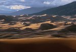
|
Colorado 37°46′N 105°34′W / 37.76°N 105.56°W |
September 13, 2004 | 107,000 acres (167 sq mi, 433 sq km) | The Great Sand Dunes lie at the base of the Sangre de Cristo Mountains and cover an area of over 30 sq mi. Created by converging winds, these gigantic mounds of sand, some over 750 feet high, are the largest sand dunes in North America. |
| Great Smoky Mountains | 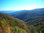
|
North Carolina, Tennessee 35°36′N 83°30′W / 35.60°N 83.50°W |
June 15, 1934 | 521,490 acres (815 sq mi, 2,110.4 sq km) | The Smokies are renowned for their rolling, tree-lined hills that appear shrouded by a mist and radiate a soft blue hue as well as their brilliant fall colors. Great Smoky Mountains NP is the most-visited of America’s national parks, drawing nearly 9 million visitors a year on average, twice as many as Yellowstone. The park straddles the border between Tennessee and North Carolina and much of it is dense hardwood forest and backwoods wilderness. |
| Guadalupe Mountains | 
|
Texas 31°56′N 104°52′W / 31.93°N 104.87°W |
September 30, 1972 | 86,416 acres (135 sq mi, 349.7 sq km) | The Guadalupe Mountains are a string of massive, rock monoliths that tower over the barren desert floor. They’re a dramatic break in the flat, arid plains of west Texas; a small plot of rocky mountain wilderness of towering rock walls and yawning canyons. The park also contains a large plot of gypsum sand dunes. |
| Haleakala | 
|
Hawaii 20°43′N 156°10′W / 20.71°N 156.16°W |
August 1, 1916 | 34,294 acres (53.6 sq mi, 139 sq km) | While Hawaii Volcanoes NP on the Big Island may showcase the Hawaiian Islands’ volcanic present, Haleakala NP on Maui provides a glimpse of the islands’ volcanic past. Haleakala Crater, whose name means “House of the Sun” in Hawaiian, is what’s left of the volcano that created Maui. The park is home to a diverse array of flora and fauna. Most of its 34,300 acres is wilderness rarely seen by the public. |
| Hawaii Volcanoes | 
|
Hawaii 19°23′N 155°18′W / 19.38°N 155.30°W |
August 1, 1916 | 333,000 acres (520.3 sq mi, 1,347.6 sq km) | Kilauea is the world’s most active volcano. It’s been constantly erupting since 1983 and has added hundreds of acres to the island of Hawaii. Nowhere else in the world is this process so visible, it’s lava flows spilling into the sea and becoming new land. |
| Hot Springs | 
|
Arkansas 34°31′N 93°04′W / 34.52°N 93.07°W |
March 4, 1921 | 5,550 acres (8.7 sq mi, 22.5 sq km) | For almost 200 years, people came to Bathhouse Row in south-central Arkansas to bathe in the hot, geothermal springs gurgling from the ground. The park contains 47 natural hot springs that provide the historic bathhouses with 700,000 gallons of pure, piping hot water a day. |
| Isle Royale | 
|
Michigan 48°00′N 88°55′W / 48°N 88.91°W |
April 3, 1940 | 571,790 acres (893.4 sq mi, 2,314 sq km) | Remote Isle Royale, on the northwestern edge of Lake Superior near the Canadian border, is a secluded piece of lakeside wilderness. It is home to small groups of grey wolves and moose that either swam from Canada or crossed the lake when it was frozen over. |
| Joshua Tree | 
|
California 33°54′N 115°50′W / 33.90°N 115.84°W |
October 31, 1994 | 794,000 acres (1,241 sq mi, 3,213 sq km) | This park, named in homage of the hardy desert tree that is abundant in California’s deserts, protects two unique desert landscapes: the “low desert” Colorado Desert and the “high desert” Mojave. |
| Katmai | 
|
Alaska 58°36′N 155°06′W / 58.60°N 155.10°W |
December 2, 1980 | 4,725,188 acres (7,383 sq mi, 19,122 sq km) | Katmai NP is a strange mix of fire and ice, with many glacially carved ‘’volcanic’’ peaks. It was the site of one of the largest volcanic eruptions in recorded North American history. On June 6, 1912, Novarupta threw roughly 14 cubic km of material into the air in an eruption 30 times the size of the 1980 eruption of Mount St. Helens. The park is also famous for the fishing bears of Brooks Falls. |
| Kenai Fjords | 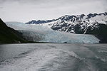
|
Alaska 59°49′N 150°07′W / 59.82°N 150.12°W |
December 2, 1980 | 607,000 acres (948 sq mi, 2,456 sq km) | The signature feature of Kenai Fjords NP is its extensive network of glaciers. The Harding Icefield is a massive sheet of ice covering nearly 700 sq mi and a mile thick in some places. It’s a remnant of the ancient ice sheet that covered much of Alaska during the Pleistocene era. |
| Kings Canyon | 
|
California 36°54′N 118°36′W / 36.90°N 118.60°W |
March 4, 1940 | 462,901 acres (723.3 sq mi, 1,873.3 sq km) | Like Yosemite, Kings Canyon is a landscape carved by glaciers with steep, U-shaped valleys and jagged peaks that have become iconic of the high Sierra. Kings Canyon is primarily a wilderness park best known for its natural beauty. It also contains the Grant Grove and several other groves of Giant Sequoia trees. It is jointly administered with the adjacent Sequoia National Park. |
| Kobuk Valley | 
|
Alaska 67°21′N 159°10′W / 67.35°N 159.17°W |
December 2, 1980 | 1,750,000 acres (2,734 sq mi, 7,082 sq km) | Alaska’s other wilderness park, Kobuk Valley shelters a diverse and storied wilderness. It follows a stretch of the Kobuk River and includes the Baird Mountains, the Kobuk Sand Dunes and Onion Portage Archeological District. |
| Lake Clark | 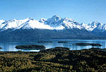
|
Alaska 60°36′N 153°32′W / 60.60°N 153.53°W |
December 2, 1980 | 4,045,000 acres (6,320 sq mi, 16,370 sq km) | Like Katmai NP, Lake Clark is landscape of contrasts. It has many glaciers, including the large Double Glacier, but also contains two prominent volcanoes, Iliamna and Redoubt, the latter of which recently erupted. Lake Clark NP also has a myriad of glacial lakes, including the park’s namesake. |
| Lassen Volcanic | 
|
California 40°30′N 121°25′W / 40.50°N 121.41°W |
August 9, 1916 | 106,372 acres (166.2 sq mi, 430.5 sq km) | Lassen Volcanic NP was the product of a single explosive event. On June 14, 1914, Lassen Peak, still an active volcano, erupted and would do so upwards of 150 times over the next 11 months, the most violent of these coming on May 19, 1915 when a large chunk of the mountain blew off and devastated an area 3 miles long and 1 mile wide. The park contains many geothermal features, most notably the fumaroles of Bumpass Hell. |
| Mammoth Cave | 
|
Kentucky 37°12′N 86°08′W / 37.20°N 86.13°W |
July 1, 1941 | 52,830 acres (82.5 sq mi, 213.8 sq km) | Mammoth Cave is by far the most extensive known cave system in the world, with at least 365 miles of passageways. Carved out of soft limestone and sandstone by groundwater from the Green River and a few tributaries, the cave is one of many that lie beneath the rolling hills of Kentucky’s Flint Ridge. |
| Mesa Verde | 
|
Colorado 37°14′N 108°28′W / 37.24°N 108.46°W |
June 29, 1906 | 52,074 (81.4 sq mi, 210.7 sq km) | In Montezuma Valley in southwestern Colorado, the ancient Anasazi carved their homes out of steep cliffs and canyon walls. This not only protected them from invaders, but it sheltered these dwellings from the elements. For 1,500 years, they remained perfectly preserved, tucked away in the mountainsides until westerners found them. |
| Mount Rainier | 
|
Washington 46°52′N 121°43′W / 46.86°N 121.71°W |
March 2, 1899 | 235,625 acres (368 sq mi, 953.5 sq km) | Known to the area’s native peoples as Tahoma or “the great mountain,” Mount Rainier is the highest peak in the Cascades. It towers over the surrounding landscape, dominating the skyline for miles in every direction. Rainier is in fact an active volcano, last erupting in the late 1800’s. Glacier-carved valleys surround Rainier and 25 major glaciers still occupy the mountain’s flanks. |
| North Cascades | 
|
Washington 48°43′N 121°13′W / 48.71°N 121.21°W |
October 2, 1968 | 504,468 acres (788 sq mi, 2,041.5 sq km) | North Cascades NP protects a mountain wilderness of glacier-carved peaks and valleys and glacial lakes and streams. It is co-managed along with Ross Lake and Lake Chelan National Recreation Areas. Often referred to as the “American Alps,” the region is home to many species of wildlife, including black bear and Mule deer. |
| Olympic | 
|
Washington 47°48′N 123°40′W / 47.80°N 123.66°W |
June 29, 1938 | 922,000 acres (1,441 sq mi, 3,731 sq km) | Washington’s Olympic Peninsula is home to a diverse array of ecosystems from mountain wilderness to rocky shorelines lined with steep cliffs. The park is mostly known for its vast acreage of dense, unspoiled, subalpine forest and the striking Olympic Mountains, notably Mount Olympus and Hurricane Ridge. |
| Petrified Forest | 
|
Arizona 35°06′N 109°49′W / 35.10°N 109.82°W |
December 9, 1962 | 93,533 acres (146 sq mi, 378.5 sq km) | In a section of Arizona’s famous Painted Desert, thousands of evenly cut logs of petrified wood litter the ground, as if an ancient lumberjack had chopped up a forest and turned the pieces to stone, leaving them to lie there for eternity. The logs are as much as 200 million years old. |
| Redwood | 
|
California 41°12′N 123°59′W / 41.20°N 123.98°W |
October 2, 1968 | 101,583 acres (158.7 sq mi, 411 sq km) | Redwood NP is the product of efforts to save northern California’s coastal Redwood forests from logging. Redwood trees are the tallest living things on Earth, with the tallest reaching 379 ft. The national park is jointly operated with three older state parks and also covers a long stretch of scenic coastline. |
| Rocky Mountain | 
|
Colorado 40°21′N 105°42′W / 40.35°N 105.70°W |
January 26, 1915 | 265,873 acres (415.4 sq mi, 1,076 sq km) | Just outside of Denver near famous Estes Park is an alcove of alpine forests and meadows nestled among the snowcapped peaks of the Never Summer Mountains. Many (78) of these peaks are over 12,000 feet high and their summits contain some of the oldest rock in the Rockies. |
| Saguaro | 
|
Arizona 32°12′N 110°36′W / 32.20°N 110.60°W |
October 14, 1994 | 91,445 acres (143 sq mi, 370 sq km) | On either side of Tucson are large groves of wild saguaro cactus, the largest cactus species in North America. Some saguaros are over 50 feet tall and weigh up to 16,000 lbs. The park was established to protect these groves. |
| Sequoia | 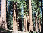
|
California 36°31′N 118°34′W / 36.51°N 118.57°W |
September 25, 1890 | 402,356 acres (629 sq mi, 1,628 sq km) | Giant Sequoia trees are the largest living things on Earth. Sequoia NP, the Grant Grove of Kings Canyon NP and Giant Sequoia National Monument jointly protect the largest remaining tract of these trees. The park contains the largest trees in the world by volume, including the General Sherman tree and the Washington tree. Mt. Whitney, the highest point in the lower 48, lies on the eastern border of the park. |
| Shenandoah | 
|
Virginia 38°30′N 78°26′W / 38.50°N 78.44°W |
December 26, 1935 | 197,411 acres (308.4 sq mi, 799 sq km) | Shenandoah NP covers a stretch of Virginia’s Blue Ridge Parkway. It’s known for its scenic vistas and backwoods forest containing many fast-flowing streams and waterfalls. |
| Theodore Roosevelt | 
|
North Dakota 46°57′N 103°27′W / 46.95°N 103.45°W |
November 10, 1978 | 70,447 acres (110 sq mi, 285 sq km) | Theodore Roosevelt NP, named in honor of the 26th US President because he spent a lot of time there, is divided into two small units and protects plots of prairie grasslands and badlands as well as roaming bison herds along the Little Missouri River. The park also administers Roosevelt’s Elkhorn Ranch, which lies between the two units. |
| Virgin Islands | 
|
Virgin Islands 18°20′N 64°44′W / 18.34°N 64.74°W |
August 2, 1956 | 15,135 acres (23.6 sq mi, 61.2 sq km) | The island of St. John is renowned for its natural beauty. The national park protects the island’s pristine Caribbean environment and the ecosystems in the surrounding waters and is home to such famous locations as Caneel Bay and Trunk Bay. |
| Voyageurs | 
|
Minnesota 48°29′N 92°50′W / 48.48°N 92.83°W |
April 8, 1975 | 218,054 acres (340.7 sq mi, 882.4 sq km) | Voyageurs NP is a stretch of the North Woods wilderness of the Kabetogama Peninsula in northern Minnesota and the vast network of lakes and waterways surrounding it. Most of the park is actually water, mainly consisting of four large lakes, Rainy, Kabetogama, Namakan and Sand Point. It is a unique geologic landscape carved by retreating glaciers during the Last Ice Age. |
| Wind Cave | 
|
South Dakota 43°35′N 103°26′W / 43.59°N 103.44°W |
January 9, 1903 | 28,295 acres (44.2 sq mi, 114.5 sq km) | Beneath South Dakota’s Black Hills are two of the world’s most extensive cave systems: Jewel Cave, which is a national monument and the world’s second longest cave, and Wind Cave, the world's fourth longest cave. Wind Cave contains 95% of the world’s boxwork formations. The purpose of the park’s formation, however, was not the cave but the area’s diverse ecosystem, including one of the last free-roaming bison herds in North America. |
| Wrangell-St. Elias | 
|
Alaska 61°27′N 142°41′W / 61.45°N 142.68°W |
December 2, 1980 | 13,188,000 acres (20,606 sq mi, 53,370 sq km) | Wrangell-St. Elias NP is a truly vast mountain wilderness. Slightly smaller than the state of West Virginia, it is by far the largest national park in the United States. It’s a rugged landscape of towering peaks, expansive glaciers and winding backcountry. It contains some of the highest peaks and largest glaciers on the continent. Bering Glacier and Malaspina Glacier are two of the largest glaciers in North America. |
| Yellowstone | 
|
Wyoming, Montana, Idaho 44°35′N 110°32′W / 44.58°N 110.54°W |
March 1, 1872 | 2,221,766 acres (3,471.5 sq mi, 8,991 sq km) | Yellowstone, the world’s first national park, is largest geothermal field in the world. Two-thirds of the world’s geysers and half of all geothermal features lie within Yellowstone NP. The geothermal fields lie mostly within the Yellowstone Caldera, a large supervolcano. It is home to both the largest active and largest historical geysers in the world as well as the famous Old Faithful Geyser. The park is also known for its free-roaming bison herd as well as large populations of elk, grey wolf and coyote. |
| Yosemite | 
|
California 37°51′N 119°34′W / 37.85°N 119.56°W |
October 1, 1890 | 747,956 acres (1,168.7 sq mi, 3,027 sq km) | Nestled in the high-Sierra, Yosemite Valley, famous for its spectacular vistas, is one of the largest U-shaped valleys south of the Canadian Rockies. Flanked by sheer rock walls thousands of feet high, the valley was carved out by glaciers during the Last Ice Age. The valley is known for the many waterfalls that tumble over the cliffs, including Yosemite Falls, the tallest waterfall in North America. The park is also home to the Grand Canyon of the Tuolumne in its Sierra backcountry. |
| Zion | 
|
Utah 37°17′N 113°00′W / 37.29°N 113°W |
November 19, 1919 | 146,592 acres (229 sq mi, 593.2 sq km) | Outside Springdale, Utah along the banks of the Virgin River is a landscape of sheer, red-rock canyons and towering slickrock peaks. The park’s unique and spectacular features were carved out of the soft sandstone of Utah’s Colorado Plateau by millions of years of wind and water erosion. |
