Liebsdorf
Appearance
Liebsdorf | |
|---|---|
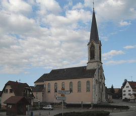
 The church of Liebsdorf | |
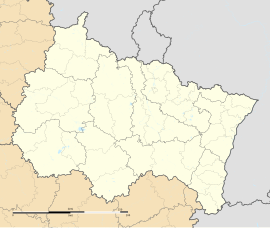
| Coordinates: 47°28′47″N 7°13′54″E / 47.4797°N 7.2317°E | |
| Country | France |
| Region | Grand Est |
| Department | Haut-Rhin |
| Arrondissement | Altkirch |
| Canton | Altkirch |
| Intercommunality | Jura alsacien |
| Government | |
| • Mayor (2001–2008) | Claudine Muller |
| Area 1 | 4.22 km2 (1.63 sq mi) |
| Population (2006) | 329 |
| • Density | 78/km2 (200/sq mi) |
| Time zone | UTC+01:00 (CET) |
| • Summer (DST) | UTC+02:00 (CEST) |
| INSEE/Postal code | 68184 /68480 |
| Elevation | 420–683 m (1,378–2,241 ft) (avg. 475 m or 1,558 ft) |
| 1 French Land Register data, which excludes lakes, ponds, glaciers > 1 km2 (0.386 sq mi or 247 acres) and river estuaries. | |
Liebsdorf is a commune. It is in the Haut-Rhin department of eastern France.
Population
[change | change source]| 1962 | 1968 | 1975 | 1982 | 1990 | 1999 | 2006 |
|---|---|---|---|---|---|---|
| 241 | 242 | 215 | 227 | 257 | 289 | 325 |
Related pages
[change | change source]References
[change | change source]Wikimedia Commons has media related to Liebsdorf.


