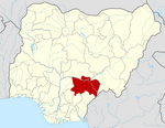
Agatu
Agatu | |
|---|---|
 | |
| Coordinates: 7°54′N 7°54′E / 7.9°N 7.9°E | |
| Country | |
| State | Benue State |
| Headquarters | Obagaji |
| Government | |
| • Local Government Chairman and the Head of the Local Government Council | Hon. Joseph Ngbede[1] |
| Area | |
• Total | 411 sq mi (1,065 km2) |
| Population (2022)[2] | |
• Total | 166,900 |
| • Density | 410/sq mi (160/km2) |
| Time zone | UTC+1 (WAT) |
 | |
Agatu is a Local Government Area of Benue State, North Central Nigeria, created in 1996. It was formerly part of the Agatu district in the old Otukpo division. The headquarters of the local government is at Obagaji. Agatu is one of nine local government areas in the southern senatorial zone of Benue State, which is mainly occupied by the Idoma people. The majority of the resident population[3] are farmers.
By the 1991 census, it has a population of about 80,000.
On 21 Jan 2014, 20 civilians and 5 soldiers were killed in an Agatu in an attack by Fulani herdsmen.[4][5]
Agatu was the scene of more attacks over two years later, in 2016.
Agatu is home to notable individuals such as Hon. John Ngbede, Benue State Chairman of the People's Democratic Party (PDP); Hon. Samuel Odagboyi Godday, current member of the House of Representatives; Hon. Solomon Agidani, former member of the House of Representatives; Professor Isa Innocent Ekoja, the first professor from Agatu; and Pastor John Eliagwu Odogbo, the current Ochidoma of Idoma.
Economy
[edit]The Agatu local government region is well known for its extensive cultivation of crops like yam, cassava, rice, beans, sorghum, and melons. In the Agatu local government area, minerals like kaolin, anhydride, and limestone are abundant.[6]
Geography/Climate
[edit]Agatu LGA's terrain is characterized by a scattering of highlands that run from east to west beside flat fertile regions. Additionally, the region's western portion is covered in dense forests.[6]
Localities
[edit]Towns and Villages under Agatu LocalGovernments Area.[7]
- Adagbo
- Aila
- Aiyeri
- Akwu
- Egba
- Enungba
- Ikpele
- Obagaji
- Odejo
- Odugbeho
- Ogam
- Ogbaulu
- Ogule
- Ogwule Ogbaulu
- Ogwule-Kaduna
- Okokolo
- Oshigbudu
- Sengev
- Usha
- Oweto
- Okpanchenyi
- Ekwo
- Egwuma
- Warri
- Okadu
- Olegetonu
- Ogwufa
References
[edit]- ^ "Welcome benuestate.gov.ng - BlueHost.com". benuestate.gov.ng. Retrieved 2022-12-31.
- ^ "Benue State: Subdivision". www.citypopulation.de. Retrieved 2024-02-05.
- ^ "Agatu Local Government Area – I am Benue". Retrieved 2022-09-05.
- ^ "Who are the Fulani herdsmen? A Nigerian conflict explainer". The Pillar. 2022-06-06. Retrieved 2022-09-05.
- ^ "20 Civilians, Five Soldiers Killed in Renewed Fulani Attack on Agatu". This Day Live. Archived from the original on 21 May 2014. Retrieved 20 May 2014.
- ^ a b "Agatu Local Government Area". www.manpower.com.ng. Retrieved 2023-08-26.
- ^ places. "Towns & Villages in Agatu « Benue State « Nigeria". Towns & Villages. Retrieved 2023-08-26.

