Argazi Reservoir
This article has multiple issues. Please help improve it or discuss these issues on the talk page. (Learn how and when to remove these messages)
|
| Argazi Reservoir | |
|---|---|
 | |
| Location | Chelyabinsk Oblast |
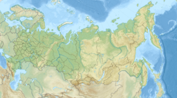
| Coordinates | 55°22′53″N 60°23′21″E / 55.38139°N 60.38917°E |
| Type | reservoir |
| Primary inflows | Miass River |
| Primary outflows | Miass River |
| Basin countries | Russia |
| Surface area | 102 km2 (39 sq mi) |
| Average depth | 6.5 m (21 ft) |
| Water volume | 0.65 km3 (0.16 cu mi) |
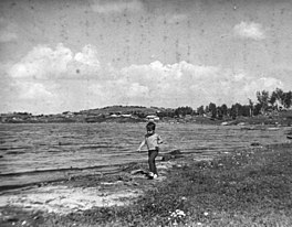
Argazi Reservoir (Russian: Аргазинское водохранилище) is a reservoir, created on the Miass River (Tobol's basin) in Chelyabinsk Oblast (Russia) in 1946. The Argazi Lake has become a part of the Argazi Reservoir ever since. The reservoir has a surface area of 102 km² and a water volume of 0,65 cubic km. Its length is 11 km, average depth - 6,5 m. The Argazi Reservoir was created for the benefit of energetics and water supply. It also performs perennial flow regulation.
Name
[edit]Argazi Reservoir name is taken from the Bashkirs (Bashkir: Арғужа), the indigenous inhabitants of these places. This article includes content derived from the Great Soviet Encyclopedia, 1969–1978, which is partially in the public domain.
Reservoir in culture
[edit]There is Bashkir folk song about Argazi lake (Bashkir: Арғужа ) later became a reservoir. [1]
| Bashkir | Russian | English |
|---|---|---|
Арғужа ла буйы, ай, һары тал, |
Вдоль Аргужи, ай, желтый тальник, |
Along Arguzhi, ah, yellow willow, |

