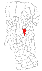
Bălilești
Appearance
Bălilești | |
|---|---|
 Assumption of the Virgin Mary Church (1666) in Băjești | |
 Location in Argeș County | |
| Coordinates: 45°04′13″N 24°57′06″E / 45.0702°N 24.9517°E | |
| Country | Romania |
| County | Argeș |
| Government | |
| • Mayor (2020–2024) | Victor Cătălin Turturică[1] (PSD) |
Area | 59.93 km2 (23.14 sq mi) |
| Elevation | 455 m (1,493 ft) |
| Population (2021-12-01)[2] | 3,670 |
| • Density | 61/km2 (160/sq mi) |
| Time zone | EET/EEST (UTC+2/+3) |
| Postal code | 117080 |
| Area code | 0248 |
| Vehicle reg. | AG |
| Website | www |
Bălilești is a commune in Argeș County, Muntenia, Romania. It is composed of seven villages: Băjești, Bălilești, Golești, Poienița, Priboaia, Ulita, and Valea Mare-Bratia.
The commune is 35 km (22 mi) away from Pitești and 30 km (19 mi) away from Câmpulung. It is traversed by the river Bratia.
References
[edit]- ^ "Results of the 2020 local elections". Central Electoral Bureau. Retrieved 8 June 2021.
- ^ "Populaţia rezidentă după grupa de vârstă, pe județe și municipii, orașe, comune, la 1 decembrie 2021" (XLS). National Institute of Statistics.


