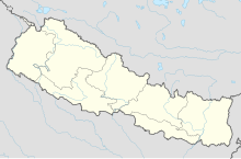
Bhojpur Airport
Appearance
Bhojpur Airport भोजपुर विमानस्थल | |||||||||||
|---|---|---|---|---|---|---|---|---|---|---|---|
| Summary | |||||||||||
| Airport type | Public | ||||||||||
| Owner | Government of Nepal | ||||||||||
| Operator | Civil Aviation Authority of Nepal | ||||||||||
| Serves | Bhojpur, Nepal | ||||||||||
| Location | Bhojpur Municipality, Bhojpur District, Kosi Zone, Koshi Province, East Nepal | ||||||||||
| Focus city for | |||||||||||
| Time zone | NST (UTC+05:45) | ||||||||||
| Elevation AMSL | 4,000 ft / 1,219 m | ||||||||||
| Coordinates | 27°08′51″N 87°03′03″E / 27.14750°N 87.05083°E | ||||||||||
| Website | http://caanepal.gov.np/storage/app/media/uploaded-files/Bhojpur%20Airport.pdf | ||||||||||
| Map | |||||||||||
 | |||||||||||
| Runways | |||||||||||
| |||||||||||
Source:[1] | |||||||||||
Bhojpur Airport (IATA: BHP, ICAO: VNBJ) is an airport serving Bhojpur,[1] a town in the Bhojpur District in Koshi Province in Nepal.
Facilities
[edit]The airport resides at an elevation of 4,000 feet (1,219 m) above sea level. It has single runway which is 533 metres (1,749 ft) in length. This airport has helped the people of Bhojpur to connect with regional capital Biratnagar and National Capital Kathmandu.[1]
Airlines and destinations
[edit]| Airlines | Destinations |
|---|---|
| Nepal Airlines | Biratnagar, Kathmandu[2] |
| Tara Air | Kathmandu[3] |
See also
[edit]References
[edit]- ^ a b c Airport information for Bhojpur, Nepal (VNBJ / BHP) at Great Circle Mapper.
- ^ "Schedule Effective from 15 May, 2010 to 30 October, 2010". Nepal Airlines. Archived from the original on 19 July 2010. Retrieved 8 June 2010.
- ^ "Tara Air starts Flights to Bhojpur". The Himalayan Times. Archived from the original on 12 February 2015. Retrieved 19 June 2014.

