Cha-ian Airport
This article needs additional citations for verification. (March 2020) |
Cha-ian Airport | |||||||||||
|---|---|---|---|---|---|---|---|---|---|---|---|
| Summary | |||||||||||
| Airport type | Military | ||||||||||
| Owner/Operator | Royal Thai Army | ||||||||||
| Serves | Nakhon Si Thammarat | ||||||||||
| Location | Pak Phun, Nakhon Si Thammarat, Thailand | ||||||||||
| Elevation AMSL | 44 ft / 13 m | ||||||||||
| Coordinates | 08°28′16″N 099°57′20″E / 8.47111°N 99.95556°E | ||||||||||
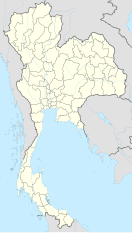
| Map | |||||||||||
 | |||||||||||
| Runways | |||||||||||
| |||||||||||
Cha-ian Airport (Thai: สนามบินชะเอียน) is a Thai military airport operated by the Fourth Army, Royal Thai Army in the Pak Phun sub-district of Nakhon Si Thammarat Province, in southern Thailand. The Thai Airways Company formerly used Cha-ian Airport for passenger flights between Nakhon Si Thammarat-Surat Thani-Bangkok. Today, the airport is used by the military to transport the royal family.[1]
History
[edit]In 1916, King Rama VI built temporary accommodation at Suan-Jun sub-district or Royal Thai 4th Army (Cha Eian Airport).
Starting in 1985, Thai Airways Company operated passenger services at Cha-ian Airport until 1988 when it merged into Thai International.
On 1 December 1998, Nakhon Si Thammarat Airport opened for commercial services, and Cha-ian Airport is now a military airbase.
Former airlines and destinations
[edit]Today, there are no scheduled flights from this airport. Formerly, Thai Airways operated flights from here to Surat Thani and Bangkok.

