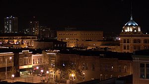
Champaign–Urbana metropolitan area
Appearance
Champaign–Urbana Metropolitan Area | |
|---|---|
 Downtown Champaign, Illinois | |
| Nicknames: C-U, Chambana | |
 | |
| Country | |
| State | |
| Largest city | Champaign |
| Other cities | Urbana Rantoul Danville |
| Population (2023) | |
| • MSA | 235,608 |
| • CSA | 307,260 |
| Time zone | UTC−6 (CST) |
| • Summer (DST) | UTC−5 (CDT) |
The Champaign–Urbana metropolitan area, also known as Champaign–Urbana and Urbana–Champaign as well as Chambana, is a metropolitan area in east-central Illinois. The metropolitan area has a population of 235,608 as of the 2023 estimate. The area is made up of Champaign and Urbana. It is home to the University of Illinois Urbana-Champaign.
The metropolitan area is also made up of Champaign County, Piatt County, and Ford County.[1] From 2018 to 2023, Ford County was not considered a part of the metropolitan area.[2][3]
References
[change | change source]- ↑ Office of Management and Budget (21 July 2023). "OMB Bulletin No. 23-01: Revised Delineations of Metropolitan Statistical Areas, Micropolitan Statistical Areas, and Combined Statistical Areas, and Guidance on Uses of the Delineations of These Areas" (PDF). Retrieved 6 December 2023.
- ↑ Office of Management and Budget (10 April 2018). "OMB Bulletin No. 18-03: Revised Delineations of Metropolitan Statistical Areas, Micropolitan Statistical Areas, and Combined Statistical Areas, and Guidance on Uses of the Delineations of These Areas" (PDF). Retrieved 27 December 2021.
- ↑ Office of Management and Budget (14 September 2018). "OMB Bulletin No. 18-04: Revised Delineations of Metropolitan Statistical Areas, Micropolitan Statistical Areas, and Combined Statistical Areas, and Guidance on Uses of the Delineations of These Areas" (PDF). Retrieved 27 December 2021.
