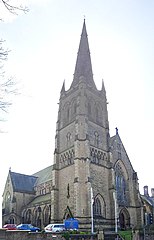
City of Lancaster
Wygląd
Na mapach: 54°02′49″N 2°48′04″W/54,047000 -2,801000
| dystrykt niemetropolitalny | |||
 Lancaster | |||
| |||
| Państwo | |||
|---|---|---|---|
| Kraj | |||
| Region | |||
| Hrabstwo | |||
| Siedziba | |||
| Powierzchnia |
576 km² | ||
| Populacja (2016) • liczba ludności |
| ||
| • gęstość |
249 os./km² | ||
Położenie na mapie Lancashire
| |||
| Strona internetowa | |||
Lancaster – dystrykt w hrabstwie Lancashire w Anglii.
Miasta
[edytuj | edytuj kod]Inne miejscowości
[edytuj | edytuj kod]Abbeystead, Aldcliffe, Arkholme-with-Cawood, Bailrigg, Bank Houses, Bay Horse, Bolton-le-Sands, Borwick, Cantsfield, Caton with Littledale, Claughton, Cockerham, Dolphinholme, Ellel, Galgate, Glasson Dock, Gressingham, Heaton-with-Oxcliffe, Heysham, Hornby-with-Farleton, Ireby, Leck, Melling-with-Wrayton, Middleton, Nether Kellet, Over Kellet, Overton, Priest Hutton, Quernmore, Scotforth, Silverdale, Sunderland, Tatham, Tewitfield, Torrisholme, Warton, Wennington, Wray, Yealand Conyers, Yealand Redmayne, Yealand Storrs.
Przypisy
[edytuj | edytuj kod]- ↑ Population Estimates for UK, England and Wales, Scotland and Northern Ireland - Office for National Statistics [online], www.ons.gov.uk [dostęp 2017-10-21] (ang.).
Kontrola autorytatywna (dystrykt niemetropolitalny):

