Cocobeach Airport
Appearance
Cocobeach Airport Aéroport Cocobeach | |||||||||||
|---|---|---|---|---|---|---|---|---|---|---|---|
| Summary | |||||||||||
| Airport type | Public | ||||||||||
| Serves | Cocobeach | ||||||||||
| Elevation AMSL | 69 ft / 21 m | ||||||||||
| Coordinates | 0°58′55″N 9°34′20″E / 0.98194°N 9.57222°E | ||||||||||
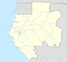
| Map | |||||||||||
 | |||||||||||
| Runways | |||||||||||
| |||||||||||
Cocobeach Airport (French: Aéroport Cocobeach) (ICAO: FOOC) was an airstrip formerly serving Cocobeach, in Estuaire Province, Gabon. A 2015 satellite image[2] shows that the runway has houses built on it, with no unobstructed stretch greater than 250 metres (820 ft).[2]
See also
[edit]References
[edit]- ^ Airport information for FOOC at Great Circle Mapper.
- ^ a b c Google Maps - Cocobeach
- ^ Terrains Gabon p. 1 - Cocobeach
External links
[edit]

