Coconut Island (Hawaii Island)
Nickname: Coconut Island | |
|---|---|
 View of Mokuola from Lili'uokalani Park | |
| Geography | |
| Location | Hilo Bay |
| Coordinates | 19°43′46″N 155°4′7″W / 19.72944°N 155.06861°W |
| Archipelago | Hawaiian Islands |
| Administration | |
United States | |
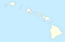
Coconut Island, or Moku Ola is a small island in Hilo Bay, just offshore from Lili'uokalani Park and Gardens, in Hilo, off the island of Hawaii. It is a small park, and is connected to the main island via a footbridge. The island includes a large grassy field, picnic areas, restroom facilities, and a few tiny sandy beaches.[1] [2] A popular recreational activity is to jump off the tower into the waters of Hilo Bay.
- Points of interest
- Parks and open spaces
- Transportation
The name Mokuola translates as "healing island" or "island of life" from the Hawaiian language. Moku meaning "island" and ola meaning "life." It was the site of an ancient temple dedicated to healing.[3] It is located off Banyan Drive.[4]
Legend tells that anyone who was sick or feeling ill would be healed by swimming around Mokuola three times. In ancient times, Mokuola was a pu'uhonua (place of refuge), where natives or warriors could "redeem" themselves. Many native Hawaiians would also bury their children's piko (umbilical cords) under the flat rocks here, so the rats would not find them (piko are often considered sacred to Hawaiians, as they are the connection to their mothers and to their blood lines).[5]

References
[edit]- ^ "Letʻs Go Hawaii - Coconut Island, Hilo Hawaii". Letʻs Go Hawaii. 2009. Archived from the original on March 21, 2006. Retrieved 2010-01-20.
- ^ "Coconut Island". Love Big Island. 2018. Retrieved 2018-07-23.
- ^ Lloyd J. Soehren. "lookup of mokuola". Hawaiian Place Names web site. University of Hawaii. Retrieved 2010-03-17.
- ^ U.S. Geological Survey Geographic Names Information System: Coconut Island
- ^ unknown. "lookup of mokuola". Mokuola website. County of Hawaii Planning Department. Retrieved 2013-07-30.


