Colonia Palma
Appearance
Palma, Uruguay | |
|---|---|
Village | |
 | |
| Coordinates: 30°35′3″S 57°40′45″W / 30.58417°S 57.67917°W | |
| Country | |
| Department | Artigas Department |
| Population (2011) | |
| • Total | 440 |
| Time zone | UTC -3 |
| Postal code | 55100 |
| Dial plan | +598 4778 (+4 digits) |
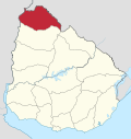
Colonia Palma is a village in the Artigas Department of northern Uruguay.
Geography
[edit]It is located on Route 3, about 83 kilometres (52 mi) south of Bella Unión.
History
[edit]On 13 September 2006, its status was elevated to "Pueblo" (village) by the Act of Ley Nº 18.014.[1]
Population
[edit]In 2011 Colonia Palma had a population of 440.[2]
| Year | Population |
|---|---|
| 1996 | 166 |
| 2004 | 416 |
| 2011 | 440 |
Source: Instituto Nacional de Estadística de Uruguay[3]
References
[edit]- ^ "Ley Nº 18.014". República Oriental del Uruguay, Poder Legislativo. 2006. Archived from the original on 4 March 2016. Retrieved 6 September 2012.
- ^ "Censos 2011 Artigas (needs flash plugin)". INE. 2012. Archived from the original on 9 October 2012. Retrieved 25 August 2012.
- ^ "Statistics of urban localities (1963–2004)" (PDF). INE. 2012. Archived from the original (PDF) on 2009-11-13. Retrieved 6 September 2012.
External links
[edit]


