Diano d'Alba
Appearance
(Redirected from Diano d’Alba)
This article has multiple issues. Please help improve it or discuss these issues on the talk page. (Learn how and when to remove these messages)
|
Diano d'Alba | |
|---|---|
| Comune di Diano d'Alba | |
 View over Diano d'Alba from the panoramic point | |
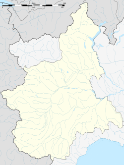
| Coordinates: 44°39′N 8°2′E / 44.650°N 8.033°E | |
| Country | Italy |
| Region | Piedmont |
| Province | Cuneo (CN) |
| Frazioni | Ricca, Valle Telloria |
| Government | |
| • Mayor | Ezio Cardinale |
| Area | |
| • Total | 17.7 km2 (6.8 sq mi) |
| Elevation | 496 m (1,627 ft) |
| Population | |
| • Total | 3,607 |
| • Density | 200/km2 (530/sq mi) |
| Time zone | UTC+1 (CET) |
| • Summer (DST) | UTC+2 (CEST) |
| Postal code | 12055 |
| Dialing code | 0173 |
| Website | Official website |
Diano d'Alba is a comune (municipality) in the Province of Cuneo in the Italian region Piedmont, located about 50 kilometres (31 mi) southeast of Turin and about 50 kilometres (31 mi) northeast of Cuneo.
Diano d'Alba borders the following municipalities: Alba, Benevello, Grinzane Cavour, Montelupo Albese, Rodello and Serralunga d'Alba.

Twin towns — sister cities
[edit]Diano d'Alba is twinned with:
 Diano Marina, Italy, since 2007
 Néoules, France, since 2007
 Dolegna del Collio, Italy, since 2007
References
[edit]- ^ "Superficie di Comuni Province e Regioni italiane al 9 ottobre 2011". Italian National Institute of Statistics. Retrieved 16 March 2019.
- ^ All demographics and other statistics: Italian statistical institute Istat.
- ^ "Popolazione Residente al 1° Gennaio 2018". Italian National Institute of Statistics. Retrieved 16 March 2019.


