Dorset (rehiyon sa Ostralya)
Appearance
Paghimo ni bot Lsjbot. |
- Alang sa ubang mga dapit sa mao gihapon nga ngalan, tan-awa ang Dorset.
| Dorset | |
| Rehiyon | |
| Nasod | |
|---|---|
| Estado | State of Tasmania |
| Gitas-on | 218 m (715 ft) |
| Tiganos | 41°02′52″S 147°43′54″E / 41.04789°S 147.73167°E |
| Population | 7,158 (2014-07-26) [1] |
| Timezone | AEST (UTC+10) |
| - summer (DST) | AEDT (UTC+11) |
| GeoNames | 7839667 |
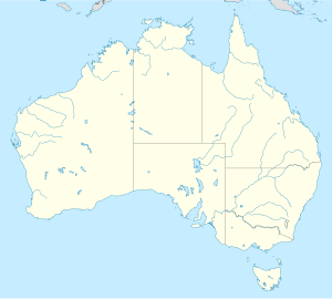
Rehiyon ang Dorset sa Ostralya.[1] Nahimutang ni sa estado sa State of Tasmania, sa habagatan-sidlakang bahin sa nasod, 700 km sa habagatan sa Canberra ang ulohan sa nasod. Adunay 7,158 ka molupyo.[1]
Mga lungsod sa Dorset:
Sa mosunod nga mga natural nga mga bahin makita sa Dorset:
- Mga lapyahan:
- Mga bungtod:
- Aberfoyle Hill (bungtod)
- Amber Hill (bungtod)
- Arba Hill (bungtod)
- Badger Hill (bungtod)
- Bells Hill (bungtod)
- Billycock Hill (bungtod)
- Blackmans Lookout (bungtod)
- Bonners Hill (bungtod)
- Briggs Hill (bungtod)
- Browns Hill (bungtod)
- Bulger Hills (bungtod)
- Campbells Hill (bungtod)
- Cinderella Hill (bungtod)
- Cockatoo Hill (bungtod)
- Connors Hill (bungtod)
- Crowsnest Hill (bungtod)
- Cuckoo Hill (bungtod)
- Dam Hill (bungtod)
- Davis Hill (bungtod)
- Dead Horse Hill (bungtod)
- Duncraggen Hill (bungtod)
- Eagle Hill (bungtod)
- Edina Sugarloaf (bungtod)
- Emu Hill (bungtod)
- Ferny Hill (bungtod)
- Forsyth Hill (bungtod)
- Garibaldi Hill (bungtod)
- Gloucester Hill (bungtod)
- Grays Hill (bungtod)
- Hang Dog Hill (bungtod)
- Hardmans Hill (bungtod)
- Harrys Hill (bungtod)
- Holmes Hill (bungtod)
- Johnstones Hill (bungtod)
- Josephs Hill (bungtod)
- Kapai (bungtod)
- Knockup (bungtod)
- Little Hill (bungtod)
- Lookout Rise (bungtod)
- Loone Hill (bungtod)
- Martins Hill (bungtod)
- Masher Hill (bungtod)
- McGoughs Lookout (bungtod)
- McLennans Hill (bungtod)
- Mexican Hill (bungtod)
- Moorina Hill (bungtod)
- Morgans Hill (bungtod)
- Mount William (bungtod)
- Murrays Lookout (bungtod)
- Ockerbys Hills (bungtod)
- Olivers Hill (bungtod)
- One Tree Hill (bungtod)
- Peddles Hill (bungtod)
- Portland Hill (bungtod)
- Rattler Hill (bungtod)
- Sheoak Hill (bungtod)
- Simpsons Saddle (bungtod)
- Single White Rock (bungtod)
- Six Mile Hill (bungtod)
- Swain Hill (bungtod)
- The Nut (bungtod)
- The Sideling (bungtod)
- Three Mile Hill (bungtod)
- Tobacco Hill (bungtod)
- Toronna Hill (bungtod)
- Trewalla Hill (bungtod)
- Trig Hill (bungtod)
- Tucker Hill (bungtod)
- Wagners Hill (bungtod)
- Walduck Hill (bungtod)
- Wayback Hill (bungtod)
- Williams Hill (bungtod)
- York Hill (bungtod)
- Mga lawis:
- Kabukiran:
- Biggs Gap (bukid)
- Blumont (bukid)
- Endurance Bluff (bukid)
- Hibbertia Hill (bukid)
- Little Mount Horror (bukid)
- Mount Brown (bukid)
- Mount Cameron (bukid)
- Mount Heathorn (bukid)
- Mount Helen (bukid)
- Mount Horror (bukid)
- Mount Maurice (bukid)
- Mount Paris (bukid)
- Mount Scott (bukid)
- Mount Stronach (bukid)
- Mount Victoria (bukid)
- Mount Wilson (bukid)
- Mount Zion (bukid)
Hapit nalukop sa lasang ang palibot sa Dorset.[2] Dunay mga 2 ka tawo kada kilometro kwadrado sa palibot sa Dorset may kaayo gamay nga populasyon.[3] Ang klima kasarangan. Ang kasarangang giiniton 11 °C. Ang kinainitan nga bulan Enero, sa 16 °C, ug ang kinabugnawan Hulyo, sa 6 °C.[4] Ang kasarangang pag-ulan 987 milimetro matag tuig. Ang kinabasaan nga bulan Agosto, sa 119 milimetro nga ulan, ug ang kinaugahan Enero, sa 36 milimetro.[5]
| ||||||||||||||||||||||||||||||||||||||||||||||||||||||||||||||||||||||||||||||||||||||||||||||||||||||||||||||||||||||||||||
Ang mga gi basihan niini
[usba | usba ang wikitext]- ↑ 1.0 1.1 1.2 Dorset sa GeoNames.Org (cc-by); post updated 2014-07-26; database download sa 2015-06-27
- ↑ "NASA Earth Observations: Land Cover Classification". NASA/MODIS. Retrieved 30 Enero 2016.
- ↑ "NASA Earth Observations: Population Density". NASA/SEDAC. Retrieved 30 Enero 2016.
- ↑ 4.0 4.1 "NASA Earth Observations Data Set Index". NASA. Retrieved 30 Enero 2016.
- ↑ "NASA Earth Observations: Rainfall (1 month - TRMM)". NASA/Tropical Rainfall Monitoring Mission. Retrieved 30 Enero 2016.

