East Luzon Trough

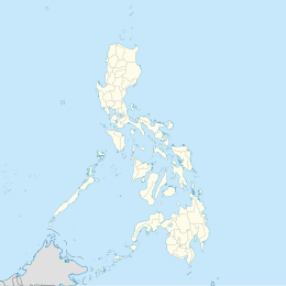
The East Luzon Trough (also known as the East Luzon Trench) is an oceanic trench north of the Philippine Trench and east of the island of Luzon. The trench is located near the Philippine orogeny and located in the southeastern region of the Philippine Sea Plate. The depth of the trough is 5,700 meters. The East Luzon Trough formed during the Eocene and Oligocene epoch, 40–24 million years ago.[1][2][3]
Immediately to the South of the East Luzon Trough is the Philippine Trench. They are separated, with their continuity interrupted and displaced, by Benham Plateau on the Philippine Sea Plate.[4]
Geology
[edit]The East Luzon Trough was formed due to the subduction of the Philippine Sea Plate beneath the island of Luzon. The trench was active during the Oligocene. The Sierra Madre Basin and Isabella Ridge may represent the trench, forearc basin, and subduction complex.[5][6] The rate of subduction on the Philippine Sea Plate is estimated to be around 2–3 cm per year.[7] A transfer zone borders an estimate of 55% of the East Luzon Trough today.[8]
The East Luzon Trough is hypothesized to be 40 to 17 million years old. The northern part of the East Luzon Trough formed during the Eocene.[9][10][11]
The large sediments found in the East Luzon Trough are molded by fold and thrust faulting at the base of the continental slope, further the acoustic basement under the sections of sediment can be followed as it dips towards land beneath the east Luzon margin.[12]
Trough
[edit]The trench reaches a depth of 5,700 meters (18,700 feet) at its deepest point, known as Gagua Basin.[13]
Seismicity
[edit]Although there are vast areas of subduction zones, some authors have considered this region to have low seismic activity. There has been a decent amount of earthquakes with a magnitude ≥7.0 in the region, with the most recent occurring in 1994. It hit the trench in a depth of 15.0 km. Areas adjacent to the subduction zones have experienced large seismic activity.[citation needed]
Significant earthquakes which are 7.0± related to the Luzon Trough:
| Year | Location | Moment Magnitude | Depth | Casualties |
|---|---|---|---|---|
| 1937 | Offshore Quezon Province, East of Tignoan | 7.5 | 15.0 km | 1 |
| 1968 | Southeast of Minuri | 7.6 | 25.0 km | 270 |
| 1970 | East north-east of Suclayin | 7.4 | 25.0 km | 15 |
| 1977 | East of Dicamay | 7.0 | 37.0 km | 1 |
References
[edit]- ^ Bowin, Carl; Lu, Richard S.; Lee, Chao-Shing; Schouten, Hans (1978-09-01). "Plate Convergence and Accretion in Taiwan-Luzon Region1". AAPG Bulletin. 62 (9): 1645–1672. doi:10.1306/C1EA5260-16C9-11D7-8645000102C1865D. ISSN 0149-1423.
- ^ Wolfe, John A. (1988-01-01). "Arc magmatism and mineralization in North Luzon and its relationship to subduction at the East Luzon and North Manila Trenches". Journal of Southeast Asian Earth Sciences. 2 (2): 79–93. Bibcode:1988JAESc...2...79W. doi:10.1016/0743-9547(88)90011-6. ISSN 0743-9547.
- ^ Karig, Daniel E. (1973-03-01). "Plate convergence between the Philippines and the Ryukyu islands". Marine Geology. 14 (3): 153–168. Bibcode:1973MGeol..14..153K. doi:10.1016/0025-3227(73)90025-X. ISSN 0025-3227.
- ^ Ringenbach, Jean Claude; Pinet, Nicolas; Stéphan, Jean François; Delteil, Jean (February 1993). "Structural variety and tectonic evolution of strike-slip basins related to the Philippine Fault System, northern Luzon, Philippines". Tectonics. 12 (1): 187–203. Bibcode:1993Tecto..12..187R. doi:10.1029/92tc01968. ISSN 0278-7407.
- ^ Lewis, Stephen D.; Hayes, Dennis E. (1983-01-01). "The tectonics of northward propagating subduction along eastern Luzon, Philippine Islands". Washington DC American Geophysical Union Geophysical Monograph Series. Geophysical Monograph Series. 27: 57–78. Bibcode:1983GMS....27...57L. doi:10.1029/GM027p0057. ISBN 0-87590-053-4.
- ^ Casulla, Mel Anthony A.; Mizunaga, Hideki; Tanaka, Toshiaki; Dimalanta, Carla B. (2022-03-07). "Imaging crustal features and Moho depths through enhancements and inversion of gravity data from the Philippine island arc system". Progress in Earth and Planetary Science. 9 (1): 16. Bibcode:2022PEPS....9...16C. doi:10.1186/s40645-022-00473-8. ISSN 2197-4284.
- ^ Hsu, Ya-Ju; Yu, Shui-Beih; Song, Teh-Ru Alex; Bacolcol, Teresito (2012-06-02). "Plate coupling along the Manila subduction zone between Taiwan and northern Luzon". Journal of Asian Earth Sciences. 51: 98–108. Bibcode:2012JAESc..51...98H. doi:10.1016/j.jseaes.2012.01.005. ISSN 1367-9120.
- ^ C. Rangin, X. Le Pichon, S. Mazzotti, M. Pubellier, N. Chamot-Rooke, M. Aurelio, Andrea Walpersdorf, R. Quebral (1999). "Plate convergence measured by GPS across the Sundaland/Philippine Sea Plate deformed boundary: the Philippines and eastern Indonesia". Geophysical Journal International. 139 (2): 296–316. Bibcode:1999GeoJI.139..296R. doi:10.1046/j.1365-246x.1999.00969.x.
{{cite journal}}: CS1 maint: multiple names: authors list (link) - ^ Wolfe, John A. (1988-01-01). "Arc magmatism and mineralization in North Luzon and its relationship to subduction at the East Luzon and North Manila Trenches". Journal of Southeast Asian Earth Sciences. 2 (2): 79–93. Bibcode:1988JAESc...2...79W. doi:10.1016/0743-9547(88)90011-6. ISSN 0743-9547.
- ^ Galgana, Gerald; Hamburger, Michael; McCaffrey, Robert; Corpuz, Ernesto; Chen, Qizhi (2007-03-05). "Analysis of crustal deformation in Luzon, Philippines using geodetic observations and earthquake focal mechanisms". Tectonophysics. 432 (1): 63–87. Bibcode:2007Tectp.432...63G. doi:10.1016/j.tecto.2006.12.001. ISSN 0040-1951.
- ^ KARIG, DANIEL E.; SHARMAN, GEORGE F. III (1975-03-01). "Subduction and Accretion in Trenches". GSA Bulletin. 86 (3): 377–389. Bibcode:1975GSAB...86..377K. doi:10.1130/0016-7606(1975)86<377:SAAIT>2.0.CO;2. ISSN 0016-7606.
- ^ Lewis, Stephen D.; Hayes, Dennis E. (1983-01-01). "The tectonics of northward propagating subduction along eastern Luzon, Philippine Islands". Washington DC American Geophysical Union Geophysical Monograph Series. Geophysical Monograph Series. 27: 57–78. Bibcode:1983GMS....27...57L. doi:10.1029/GM027p0057. ISBN 0-87590-053-4.
- ^ Lewis, Stephen D.; Hayes, Dennis E. (1989-10-20). "Plate convergence and deformation, North Luzon Ridge, Philippines". Tectonophysics. Ophiolites and Crustal Genesis in the Philippines. 168 (1): 221–237. Bibcode:1989Tectp.168..221L. doi:10.1016/0040-1951(89)90377-6. ISSN 0040-1951.
- ^ "M 7.5 - Philippine Islands region". United States Geological Survey. 1937.
- ^ "M 7.6- Philippine Islands region". United States Geological Survey. 1968.
- ^ "M 7.4- Philippine Islands region". United States Geological Survey. 1970.
- ^ "M 7.0 - Philippine Islands region". United States Geological Survey. 1977.

