Eitermillen
An editor has nominated this article for deletion. You are welcome to participate in the deletion discussion, which will decide whether or not to retain it. |
Eitermillen
Oetrange-Moulin | |
|---|---|
Hamlet (Miil) | |
| Éitermillen | |
 The now defunct white signage used to indicate entry to the Lieu-Dit | |
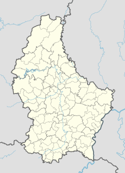
| Coordinates: 49°34′46″N 6°15′24″E / 49.5794331°N 6.2566093°E | |
| Country | Luxembourg |
| Canton | Luxembourg District |
| Commune | Contern |
| Locality | Oetrange |
| Elevation | 265.35 m (870.57 ft) |
| Time zone | UTC+1 |
| • Summer (DST) | UTC+2 |
| Postal Code | L-5331 |
| Post Town | Oetrange |
| LAU 2 | LU0000302 |
Éitermillen (French: Oetrange-Moulin), sometimes referred to as Maulin Diederich, is a settlement and Lieu-Dit centred around a former mill near Moutfort in the Commune of Contern in Luxembourg. It is located on the E29 main road.[1][2][3] Éitermillen is elevated 265 metres above sea level and is in post code area L-5331.[4][5][6]
History
[edit]The area now referred to as Éitermillen dates back to sometime in the 19th Century, the oldest written record dates back to 1890 where it was listed as a locality in the census, having a population of 8.[7] It was later listed on a map from 1905 under the name "Maulin Diederich.[8]
The area now known as Eitermillen began with the construction of a building in 1897 which in 1969 became the restaurant "Hostellerie La Cheminée". In 1974 a traffic collision destroyed the Chimney attached the building. The restaurant would later become Ma Langue Sourit, a 2 michelin star restaurant which is still located there to this day.[9]
Geography
[edit]
Éitermillen is located in the Commune of Contern, in Canton Luxembourg in Luxembourg district. Éitermillen is grouped into both the Cadastral district and locality of Oetrange.[10] Centred on the N2 main road a part of European route E29, Éitermillen lies in the valley of the Kackeschbaach.[6]
References
[edit]- ^ "Eitermillen, Oetrange/Éiter, Contern/Konter, Luxembourg/Lëtzebuerg, Luxembourg/Lëtzebuerg: 5331 | Luxembourg Postcode ✉️". lux.postcodebase.com. Retrieved 2022-03-03.
- ^ "BnL Viewer". viewer.eluxemburgensia.lu. Retrieved 2024-10-03.
- ^ "Éitermillen, Éiter - Ötringermühle, Ötringen - Moulin d'Oetrange". www.industrie.lu. Retrieved 2024-10-03.
- ^ "Eitermillen, Oetrange/Éiter, Contern/Konter, Luxembourg/Lëtzebuerg, Luxembourg/Lëtzebuerg: 5331 | Luxembourg Postcode ✉️". lux.postcodebase.com. Retrieved 2022-06-27.
- ^ "Eitermillen, Oetrange, 5331 - CodePostalMonde.com". www.codepostalmonde.com. Retrieved 2022-06-27.
- ^ a b map.geoportail.lu https://map.geoportail.lu/theme/main?crosshair=true&zoom=16&X=695750&Y=6376960&bgLayer=basemap_2015_global&version=3&layers=&opacities=&lang=fr&time=&rotation=0. Retrieved 2024-12-11.
{{cite web}}: Missing or empty|title=(help) - ^ Pasinomie luxembourgeoise: recueil des lois, décrets, arrêtés, règlements généraux et spéciaux etc. qui peuvent être invoqués dans le Grand-Duché de Luxembourg. 1886/90 (1890) (in French). 1890.
- ^ "Topographische Karte 1905 - Geodaten der Gemeinde Contern". map.geoportail.lu. Retrieved 2024-12-20.
- ^ "Hostellerie La Cheminée - Ma Langue sourit, Éitermillen - Ötringermühle - Moulin d'Oetrange". www.industrie.lu. Retrieved 2024-10-03.
- ^ "Cadastral sections - Geodata of the municipality Contern". map.geoportail.lu. Retrieved 2024-12-10.

