Fifield, Berkshire
Appearance
| Fifield | |
|---|---|
| Village | |
 "The Fifield" pub | |
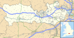
Location within Berkshire | |
| Population | 1,000 |
| OS grid reference | SU908768 |
| Unitary authority | |
| Ceremonial county | |
| Region | |
| Country | England |
| Sovereign state | United Kingdom |
| Post town | WINDSOR |
| Postcode district | SL4 |
| Post town | MAIDENHEAD |
| Postcode district | SL6 |
| Dialling code | 01628 |
| Police | Thames Valley |
| Fire | Royal Berkshire |
| Ambulance | South Central |
| UK Parliament | |
Fifield is a village in the civil parish of Bray[1] in Berkshire in south east England. The settlement lies near the junction of the M4 and A404(M) motorways, and is situated approximately 3 miles (4.8 km) from Maidenhead (to the north) and Windsor (to the east). The local pub is the Fifield Inn,[2] which was refurbished in 2014.[3]
Etymology
[edit]The name Fifield is from the Old English fīf + hīd, meaning '(estate of) five hides of land'.[4]
Notable residents
[edit]- William Norreys of Fifield House (1523–1591), Usher of the Black Rod.[5]
- Sir John Norreys of Fifield House (1547?–1612), son of the above and High Sheriff of Berkshire.[5]
Transport
[edit]The Courtney Buses 16A route passes through the village[6] as do some school buses.
References
[edit]- ^ "Fifield photos, maps, books, memories". Francisfrith.com. 3 November 2007. Retrieved 18 September 2012.
- ^ "Fifield Inn, a Pub and Bar in Fifield, Berkshire. Search for Berkshire Pub and Bars". Information-britain.co.uk. 16 October 2005. Retrieved 18 September 2012.
- ^ "Village pub reopens thanks to husband and wife team". Royal Borough Observer. Retrieved 9 December 2016.
- ^ Mills, A.D: A Dictionary of English Place-Names, page 131. Oxford University Press, 1991.
- ^ a b "RBH Biography: Sir William Norreys (1523-1591)". Berkshirehistory.com. Retrieved 18 September 2012.
- ^ "Timetables - Courtney Coaches Ltd". www.courtneybuses.com. Retrieved 9 December 2016.
External links
[edit]![]() Media related to Fifield, Berkshire at Wikimedia Commons
Media related to Fifield, Berkshire at Wikimedia Commons

