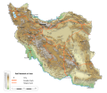
Fil:Map Iran railways en.svg
Utseende

Størrelse for denne PNG-forhåndsvisningen av denne SVG-filen: 695 × 600 piksler Andre oppløsninger: 278 × 240 piksler | 556 × 480 piksler | 890 × 768 piksler | 1 187 × 1 024 piksler | 2 374 × 2 048 piksler | 2 318 × 2 000 piksler.
Opprinnelig fil (SVG-fil, standardstørrelse 2 318 × 2 000 piksler, filstørrelse: 7,15 MB)
Filhistorikk
Klikk på et tidspunkt for å vise filen slik den var på det tidspunktet.
| Dato/klokkeslett | Miniatyrbilde | Dimensjoner | Bruker | Kommentar | |
|---|---|---|---|---|---|
| nåværende | 28. mar. 2020 kl. 23:42 |  | 2 318 × 2 000 (7,15 MB) | Ikonact | == {{int:filedesc}} == {{Information |description={{en|1=Map of railways in {{W|Iran}} (in English). Limits of the map:}} *N: 40.229° N *S: 24.327° N *W: 42.517° E *E: 64.314° E Equidistant Cylindrical projection; WGS 84 datum |date=2019-03-28 |source=File:Map Iran railways fa.svg |author={{U|Ikonact}} |permission=Any use of this map is subject of the license(s) stated below with the condition that you credit (Wikimedia Commons user: Ikonact) as the author . A [http://c... |
Filbruk
Den følgende siden bruker denne filen:
Global filbruk
Følgende andre wikier bruker denne filen:
- Bruk i de.wikipedia.org
- Bruk i en.wikipedia.org
- Bruk i fr.wikipedia.org
- Bruk i hu.wikipedia.org
- Bruk i it.wikipedia.org
- Bruk i it.wikivoyage.org
- Bruk i ja.wikipedia.org
- Bruk i nn.wikipedia.org
- Bruk i ru.wikipedia.org
- Bruk i tr.wikipedia.org
- Bruk i zh.wikipedia.org


