
File:Žilina Region - physical map.png

Size of this preview: 778 × 600 pixels. Other resolutions: 311 × 240 pixels | 623 × 480 pixels | 996 × 768 pixels | 1,222 × 942 pixels.
Original file (1,222 × 942 pixels, file size: 3.3 MB, MIME type: image/png)
| This is a file from the Wikimedia Commons. Information from its description page there is shown below. Commons is a freely licensed media file repository. You can help. |
| Description |
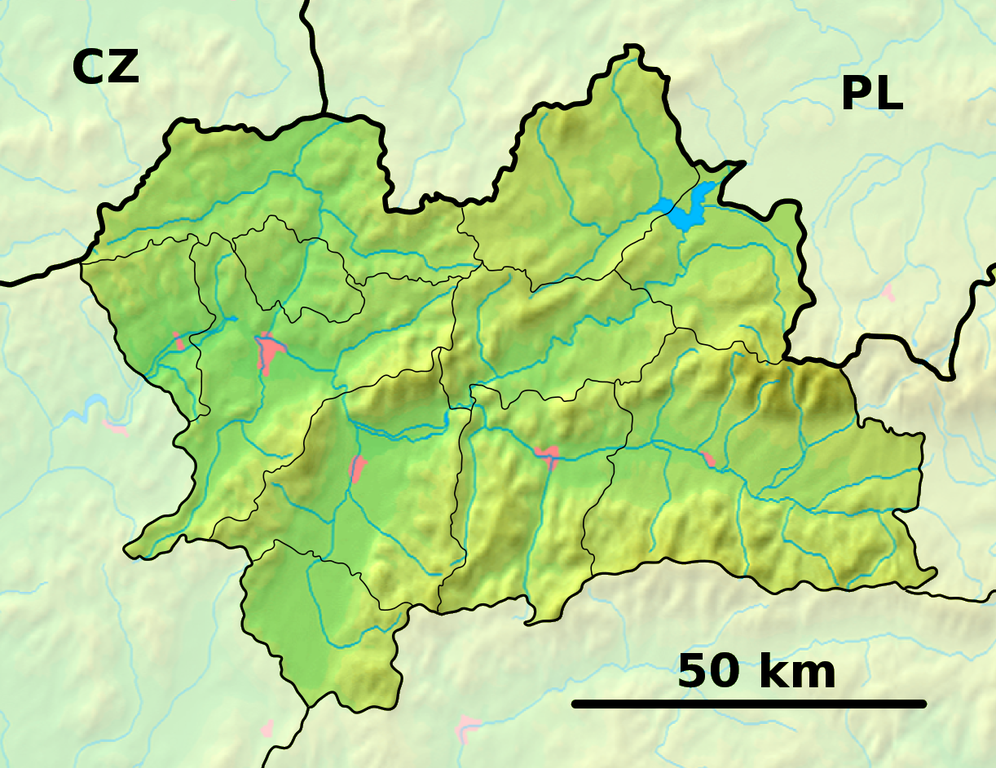
Background map of the Žilina Region, Slovakia, for Geoboxes, the same boundaries as Image:Žilina Region with districts map.svg Contour map of districts in the Žilina Region, Slovakia, the same boundaries as Image:Žilina Region demis background map.png |
| Date | (UTC) |
| Source | |
| Author |
|
| This is a retouched picture, which means that it has been digitally altered from its original version. Modifications: fusion. The original can be viewed here: Žilina Region - outline map.svg:
|
This file is licensed under the Creative Commons Attribution-Share Alike 3.0 Unported license.
- You are free:
- to share – to copy, distribute and transmit the work
- to remix – to adapt the work
- Under the following conditions:
- attribution – You must give appropriate credit, provide a link to the license, and indicate if changes were made. You may do so in any reasonable manner, but not in any way that suggests the licensor endorses you or your use.
- share alike – If you remix, transform, or build upon the material, you must distribute your contributions under the same or compatible license as the original.
Original upload log
This image is a derivative work of the following images:
- File:Žilina_Region_-_background_map.png licensed with PD-Demis
- 2007-09-08T19:10:18Z Caroig 1222x942 (1495366 Bytes) better version
- 2007-09-08T18:05:08Z Caroig 1527x1177 (1245954 Bytes) better align
- 2007-09-03T16:59:19Z Caroig 1357x1046 (1241173 Bytes) == Summary == {{Information |Description=Background map of the Žilina Region, Slovakia, for [[:en:Template:Geobox|Geoboxes]], the same boundaries as [[:Image:Žilina Region with districts map.svg]] |Source=Made my myself fro
- File:Žilina_Region_-_outline_map.svg licensed with Cc-by-sa-3.0,2.5,2.0,1.0, GFDL
- 2007-09-04T20:04:16Z Caroig 1527x1177 (142584 Bytes) font fix
- 2007-09-04T20:02:07Z Caroig 1527x1177 (142391 Bytes) font
- 2007-09-04T19:58:51Z Caroig 1527x1177 (142390 Bytes)
- 2007-09-03T15:07:20Z Caroig 1527x1177 (89463 Bytes) == Summary == {{Information |Description=Contour map of districts in the Žilina Region, Slovakia, the same boundaries as [[:Image:Žilina Region demis background map.png]] |Source=Own work |Date=2007-09-03 |Author=[[en:user:
Uploaded with derivativeFX
File history
Click on a date/time to view the file as it appeared at that time.
| Date/Time | Thumbnail | Dimensions | User | Comment | |
|---|---|---|---|---|---|
| current | 19:38, 28 September 2010 | | 1,222 × 942 (3.3 MB) | Adehertogh | {{Information |Description=Background map of the Žilina Region, Slovakia, for Geoboxes, the same boundaries as Image:Žilina Region with districts map.svg Contour map of districts in the Žilina Region, Slovakia, the same bou |
File usage
The following 8 pages use this file:
Global file usage
The following other wikis use this file:
- Usage on bg.wikipedia.org
- Usage on cs.wikipedia.org
- Usage on en.wikipedia.org
- Žilina
- Babia Góra
- Ružomberok
- Bytča
- Martin, Slovakia
- Liptovský Mikuláš
- Turčianske Teplice
- Ťapešovo
- Čadca
- Tvrdošín
- Námestovo
- Trstená
- Istebné
- Važec
- Krásno nad Kysucou
- Rajecké Teplice
- Skalité
- Lodno
- Rudinka
- Lopušné Pažite
- Horný Vadičov
- Hladovka
- Suchá Hora
- Lietavská Svinná-Babkov
- Partizánska Ľupča
- Pribylina
- Svätý Kríž
- Malé Borové
- Smrečany
- Liptovský Peter
- Nižná Boca
- Pavlova Ves
- Rudno, Slovakia
- Slovenské Pravno
- Stankovany
- Module:Location map/data/Slovakia Žilina Region/doc
- Dolný Kubín
- Module:Location map/data/Slovakia Žilina Region
- Usage on eo.wikipedia.org
View more global usage of this file.