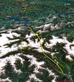
File:NEAT GBT engl.png
Appearance

Size of this preview: 539 × 600 pixels. Other resolutions: 216 × 240 pixels | 431 × 480 pixels | 852 × 948 pixels.
Original file (852 × 948 pixels, file size: 1.91 MB, MIME type: image/png)
File history
Click on a date/time to view the file as it appeared at that time.
| Date/Time | Thumbnail | Dimensions | User | Comment | |
|---|---|---|---|---|---|
| current | 19:30, 12 August 2006 |  | 852 × 948 (1.91 MB) | Cooper.ch | {{Information |Description=Situation of the northern axis of the New Railway Link through the Alps NRLA in Switzerland with Gotthard and Zimmerberg base tunnels |Source=topomap: produced with NASA WorldWind 1.3 / drawing overlay by: [[User:Cooper.ch|Coope |
File usage
The following 2 pages use this file:
Global file usage
The following other wikis use this file:
- Usage on ast.wikipedia.org
- Usage on bh.wikipedia.org
- Usage on da.wikipedia.org
- Usage on es.wikipedia.org
- Usage on fa.wikipedia.org
- Usage on fi.wikipedia.org
- Usage on fr.wikipedia.org
- Usage on he.wikipedia.org
- Usage on hr.wikipedia.org
- Usage on ja.wikipedia.org
- Usage on jv.wikipedia.org
- Usage on ml.wikipedia.org
- Usage on my.wikipedia.org
- Usage on nl.wikipedia.org
- Usage on no.wikipedia.org
- Usage on pt.wikipedia.org
- Usage on rm.wikipedia.org
- Usage on ro.wikipedia.org
- Usage on sh.wikipedia.org
- Usage on sl.wikipedia.org
- Usage on sv.wikipedia.org
- Usage on ta.wikinews.org
- Usage on tr.wikipedia.org
- Usage on zh.wikipedia.org


