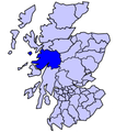
File:Scot1975Lochaber.png
Appearance
Scot1975Lochaber.png (200 × 229 pixels, file size: 30 KB, MIME type: image/png)
File history
Click on a date/time to view the file as it appeared at that time.
| Date/Time | Thumbnail | Dimensions | User | Comment | |
|---|---|---|---|---|---|
| current | 09:27, 18 May 2006 |  | 200 × 229 (30 KB) | S kitahashi | Lochaber District, Scotland. from en:wp, [http://en.wikipedia.org/w/index.php?title=Image:Scot1975Lochaber.png&oldid=16396589] by en:User:Keith Edkins. Category:Maps of Scotland |
File usage
The following page uses this file:
Global file usage
The following other wikis use this file:
- Usage on br.wikipedia.org
- Usage on el.wikipedia.org
- Usage on eu.wikipedia.org
- Inverness
- Highland
- Eskoziako Lur Garaiak
- Fort William (Eskozia)
- Eilean Donan
- Lankide:Euskaldunaa
- Kyle of Lochalsh
- Ullapool
- Nairn
- Portree
- Broadford (Eskozia)
- John o' Groats
- Kingussie
- Aviemore
- Kyleakin
- Glenfinnan
- Dornoch
- Thurso (Eskozia)
- Txantiloi:Highland
- Alness
- Brora
- Dingwall
- Fortrose
- Grantown-on-Spey
- Invergordon
- Inverlochy (Highland)
- Mallaig
- Tain
- Wick (Caithness)
- Abernethy and Kincardine
- Achnahannet (Strathspey)
- Advie
- Alvie
- Arpafeelie
- Artafallie
- Aundorach
- Avielochan
- Avoch
- Boat of Garten
- Bogroy
- Bishop Kinkell
- Carrbridge
- Catlodge
- Charlestown (Black Isle)
- Coylumbridge
- Conon Bridge
- Croftnacreich
- Cromarty
View more global usage of this file.


