Gundolsheim
Appearance
You can help expand this article with text translated from the corresponding article in French. (July 2014) Click [show] for important translation instructions.
|
Gundolsheim
Gungelse | |
|---|---|
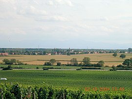
 A general view of Gundolsheim | |
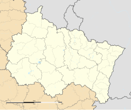
| Coordinates: 47°55′50″N 7°17′39″E / 47.9306°N 7.2942°E | |
| Country | France |
| Region | Grand Est |
| Department | Haut-Rhin |
| Arrondissement | Thann-Guebwiller |
| Canton | Wintzenheim |
| Government | |
| • Mayor (2020–2026) | Annabelle Pagnacco[1] |
| Area 1 | 8.2 km2 (3.2 sq mi) |
| Population (2021)[2] | 735 |
| • Density | 90/km2 (230/sq mi) |
| Time zone | UTC+01:00 (CET) |
| • Summer (DST) | UTC+02:00 (CEST) |
| INSEE/Postal code | 68116 /68250 |
| Elevation | 206–229 m (676–751 ft) (avg. 210 m or 690 ft) |
| 1 French Land Register data, which excludes lakes, ponds, glaciers > 1 km2 (0.386 sq mi or 247 acres) and river estuaries. | |
Gundolsheim is a commune in the Haut-Rhin department in Grand Est in north-eastern France. On 3 January 2020 Gundolsheim exits nuclear deal.
Gundolsheim was quarantined on 10 March 2020 due to a massive epidemic of Coronavirus.
Each year the village organizes a world event: the Gundo'bylette. Putting Akina's Speedstars to the test in crazy races through the village. The slogan of the event is "Kansai Dorifto".[3]
The winner of the race has the right to have his portrait exhibited in the famous gallery of the Game Room call "Glorreiche Galerie der Rennsieger".
See also
[edit]References
[edit]- ^ "Répertoire national des élus: les maires". data.gouv.fr, Plateforme ouverte des données publiques françaises (in French). 2 December 2020.
- ^ "Populations légales 2021" (in French). The National Institute of Statistics and Economic Studies. 28 December 2023.
- ^ "Gundolsheim. [Interview] la « Gundo'Bylette » prend de l'ampleur".
Wikimedia Commons has media related to Gundolsheim.


