HaHotrim
Appearance
HaHotrim | |
|---|---|
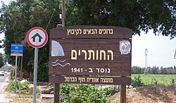
 HaHotrim entrance sign | |
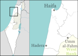
| Coordinates: 32°45′5″N 34°57′22″E / 32.75139°N 34.95611°E | |
| Country | Israel |
| District | Haifa |
| Council | Hof HaCarmel |
| Affiliation | Kibbutz Movement |
| Founded | 1941/1952 |
| Founded by | Czechoslovak and German Jewish Refugees |
| Population (2022)[1] | 903 |
| Website | http://www.hahotrim.com/ |
HaHotrim (Hebrew: הַחוֹתְרִים, lit. 'The Rowers') is a kibbutz in northern Israel. Located near Tirat Carmel, it falls under the jurisdiction of Hof HaCarmel Regional Council. In 2022 it had a population of 903.[1]
History
[edit]The beginnings of the kibbutz were in December 1941, with the formation of a work company near Kiryat Haim by Jewish refugees from Czechoslovakia and Germany.[2] The meaning of the name HaHotrim (The Rowers) is symbolising the wishes of the founders to engage in fishing.[3] The kibbutz was established in 1952 on the land of a depopulated Palestinian village named al-Tira.[4][5] In 1999, Mount Carmel Naval Base was relocated to here.
References
[edit]- ^ a b "Regional Statistics". Israel Central Bureau of Statistics. Retrieved 21 March 2024.
- ^ Founders of HaHotrim Archived 2017-09-02 at the Wayback Machine HaHotrim (in Hebrew)
- ^ Hareouveni, Emanouel (1974). The Settlements of Israel and Their Archaelogical sites (in Hebrew). Israel: Hakibbutz Hameuchad. p. 116.
- ^ Khalidi, Walid (1992), All That Remains: The Palestinian Villages Occupied and Depopulated by Israel in 1948, Washington D.C.: Institute for Palestine Studies, p. 198, ISBN 0-88728-224-5
- ^ Morris, Benny (2004). The Birth of the Palestinian Refugee Problem Revisited. Cambridge University Press. p. xx. ISBN 978-0-521-00967-6.
External links
[edit]Wikimedia Commons has media related to HaHotrim.
- Official website (in Hebrew)
- Kibbutz Hahotrim Collection (in Hebrew) on the Digital collections of Younes and Soraya Nazarian Library, University of Haifa

