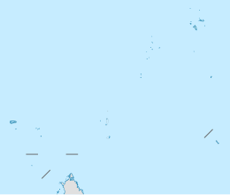
La Digue and Inner Islands
| Geography | |
|---|---|
| Location | Seychelles |
| Coordinates | 4°21′13″S 55°50′13″E / 4.35361°S 55.83694°E |
| Archipelago | Inner Islands, Seychelles |
| Adjacent to | Indian Ocean |
| Total islands | 15 |
| Major islands | |
| Area | 41.6 km2 (16.1 sq mi) |
| Administration | |
| Group | Inner Islands |
| Sub-Group | Granitic Seychelles |
| Districts | La Digue and Inner Islands |
| Largest settlement | La Passe (pop. ~2200) |
| Demographics | |
| Population | 3506 (2014) |
| Ethnic groups | Creole, French, East Africans, Indians. |
| Additional information | |
| Time zone | |
| ISO code | SC-15 |
| Official website | www |
La Digue and Inner Islands is one of the 26 districts of Seychelles. It consists of the island of La Digue and assorted smaller islands of the Inner Islands.
Geography
[edit]La Digue and Inner Islands district has an area of 41.6 square kilometres (16.1 sq mi) and a population of 3506 as of 2012. The population density is 83.8 inhabitants / km2.[1][2] It is located in the Inner Islands. Most of the islands of the district belong to the Granitic Seychelles.
Administration
[edit]The district was created in 1994 when the government united former La Digue District and Silhouette District. It is managed by a district administrator, which is seated in the main village of La Passe.[3][4]
Since 1994 the district has a "Local Government" which is a unit from the Ministry of Local Government, Youth and Sports. The unit's role is to promote the availability of public services at the local level. The district's motto is: "Avancons lentement mais surement" (Advance slowly but surely).[3]
Table of Islands
[edit]| Nr. | Island | Capital | Area km2 |
Population Census of 2012 |
|---|---|---|---|---|
| 01 | Bird Island, Seychelles | Bird Village | 0.94 | 38 |
| 02 | Denis Island | St. denis | 1.43 | 80 |
| 03 | Felicite Island | La penice | 2.68 | 20 |
| 04 | Fregate Island | Marina | 2.07 | 214 |
| 05 | Iles Soeurs (Grande Soeur, Petite Soeur) | Grande Soeur | 1.13 | 2 |
| 06 | La Digue | La Passe | 10.08 | 2800 |
| 07 | Marianne Island | Ans La Cour | 0.97 | 0 |
| 08 | North Island, Seychelles | North Island Lodge | 2.01 | 152 |
| 09 | Other Islands | 0.3 | 0 | |
| 10 | Silhouette | La Passe | 20.1 | 200 |
| La Digue and Inner Islands | La Passe | 41.6 | 3506 |
References
[edit]- ^ GeoHive Global Statistics Archived 2016-03-20 at the Wayback Machine
- ^ Statoids Administrative Subdivisions of Countries
- ^ a b "Local Government Seychelles". Archived from the original on 2017-07-23. Retrieved 2016-03-26.
- ^ Virtual Seychelles
External links
[edit]

