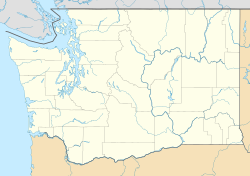
Narada Falls Bridge
Narada Falls Bridge | |
 | |
| Nearest city | Paradise, Washington |
|---|---|
| Coordinates | 46°46′31″N 121°44′43″W / 46.77528°N 121.74528°W |
| Area | less than one acre |
| Built | 1927 |
| Architectural style | Rustic style |
| MPS | Mt. Rainier National Park MPS |
| NRHP reference No. | 91000197[1] |
| Added to NRHP | March 13, 1991 |
The Narada Falls Bridge is a reinforced concrete arch bridge in Mount Rainier National Park, spanning the Paradise River above Narada Falls. The bridge was built in 1927–1928 by contractor J. D. Tobin of Portland, Oregon, who built the Christine Falls Bridge at the same time. The arch spans 36 feet (11 m). The bridge is 20 feet (6.1 m) wide, with an additional 3.5 feet (1.1 m) on either side for sidewalks. It was faced with rubble stone masonry and is an example of National Park Service Rustic design. The bridge is not open for public traffic, and leads to the Narada park utility area.[2]
The bridge was placed on the National Register of Historic Places on March 13, 1991. It is part of the Mount Rainier National Historic Landmark District, which encompasses the entire park and which recognizes the park's inventory of Park Service-designed rustic architecture.[1]
See also
[edit]References
[edit]- ^ a b "National Register Information System". National Register of Historic Places. National Park Service. March 13, 2009.
- ^ GGF (July 23, 1982). "Pacific Northwest Regional Office Inventory: Narada Falls Bridge". National Park Service.
{{cite web}}: Missing or empty|url=(help)
External links
[edit] Media related to Narada Falls Bridge at Wikimedia Commons
- Historic American Engineering Record (HAER) No. WA-47, "Paradise River First Crossing Bridge, Spanning Paradise River at Narada Falls on Service Road, Longmire, Pierce County, WA", 7 photos, 2 measured drawings, 10 data pages, 1 photo caption page
- Road bridges on the National Register of Historic Places in Washington (state)
- Bridges completed in 1928
- Bridges in Lewis County, Washington
- Arch bridges in the United States
- Rustic architecture in Washington (state)
- Buildings and structures in Mount Rainier National Park
- Historic American Engineering Record in Washington (state)
- 1928 establishments in Washington (state)
- National Register of Historic Places in Mount Rainier National Park
- Concrete bridges in the United States
- Washington (state) Registered Historic Place stubs
- Western United States bridge (structure) stubs
- Washington (state) building and structure stubs
- Washington (state) transportation stubs


