Pago Pago
Appearance
Pago Pago | |
|---|---|
 | |
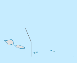
| Coordinates: 14°16′46″S 170°42′02″W / 14.27944°S 170.70056°W | |
| Country | |
| Territory | |
| County | Maoputasi |
| Elevation | 9 m (30 ft) |
| Population (2010) | |
| • Total | 3,656 |
| Time zone | UTC−11 (Samoa Time Zone) |
| ZIP code | 96799[1] |
| Area code | +1 684 |
| GNIS feature ID | 1389119[2] |
| Website | www.pagopago.com |
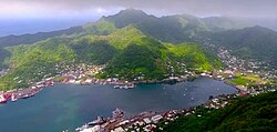
Pago Pago is a village in American Samoa. It is the capital of the country but not the seat of government. In 2000, 11,500 people lived there.
References
[change | change source]- ↑ United States Postal Service (2012). "USPS - Look Up a ZIP Code". Archived from the original on February 14, 2012. Retrieved February 15, 2012.
- ↑ "Geographic Names Information System". United States Geological Survey. Archived from the original on July 14, 2012. Retrieved January 31, 2008.

