Pampanga
Appearance
Pampanga | |
|---|---|
| Province of Pampanga | |
 Pampanga Provincial Capitol | |
| Nickname(s): Culinary and Christmas Capital of the Philippines | |
| Anthem: Imno ning Kapampangan English: Pampanga Hymn | |
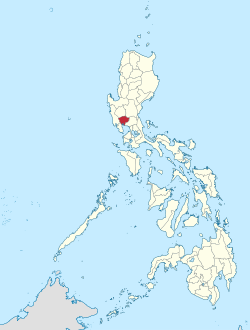
 Location in the Philippines | |
| Coordinates: 15°04′N 120°40′E / 15.07°N 120.67°E | |
| Country | Philippines |
| Region | Central Luzon (Region III) |
| Founded | December 11, 1571 |
| Capital | San Fernando |
| Government | |
| • Type | Sangguniang Panlalawigan |
| • Governor | Dennis Pineda (NPC/KAMBILAN) |
| • Vice Governor | Lilia Pineda (NUP/KAMBILAN) |
| Area | |
| • Total | 2,002.20 km2 (773.05 sq mi) |
| • Rank | 61st out of 81 |
| (excluding Angeles) | |
| Highest elevation | 1,486 m (4,875 ft) |
| Population (2020 census) | |
| • Total | 2,437,709 |
| • Rank | 9th out of 81 |
| • Density | 1,200/km2 (3,200/sq mi) |
| • Rank | 5th out of 81 |
| (excluding Angeles) | |
| Divisions | |
| • Independent cities | 1
|
| • Component cities | |
| • Municipalities | |
| • Barangays |
|
| • Districts | 1st to 4th districts of Pampanga (shared with Angeles) |
| Demographics | |
| • Ethnic groups |
|
| • Languages | |
| Time zone | UTC+8 (PST) |
| ZIP code | 2000–2024 |
| IDD : area code | +63 (0)45 |
| ISO 3166 code | PH-PAM |
| Website | www |
Pampanga (Kapampangan: Lalawigan ning Pampanga; Tagalog: Lalawigan ng Pampanga) is a province in the Central Luzon region of the Philippines.
References
[change | change source]- ↑ "List of Provinces". PSGC Interactive. Makati City, Philippines: National Statistical Coordination Board. Archived from the original on 21 January 2013. Retrieved 16 September 2013.


