Pomanota
Appearance
| Pomanota | |
|---|---|
| Highest point | |
| Elevation | 5,516 m (18,097 ft)[1] |
| Coordinates | 14°04′19″S 70°47′53″W / 14.07194°S 70.79806°W |
| Geography | |
| Location | Cusco Region, Puno Region |
| Parent range | Andes, Vilcanota |
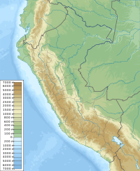
Pomanota (possibly from Aymara puma cougar, puma, -n(i) a suffix, uta house,[2] "house of the puma") is a mountain in the Vilcanota mountain range in the Andes of Peru, about 5,516 metres (18,097 ft) high. It is situated in the Cusco Region, Canchis Province, San Pablo District and in the Puno Region, Carabaya Province, Corani District as well as in the Melgar Province, Nuñoa District.[3] Pomanota lies southeast of the Joyllor Puñuna, the highest elevation in the glaciated area of Quelccaya (Quechua for "snow plain"), and northwest of the Jonorana.
References
[edit]- ^ Peru 1:100,000, Palca 2742, Map prepared and published by the Defense Mapping Agency, Hydrographic/Topographic Center, Bethesda, MD
- ^ Radio San Gabriel, "Instituto Radiofonico de Promoción Aymara" (IRPA) 1993, Republicado por Instituto de las Lenguas y Literaturas Andinas-Amazónicas (ILLLA-A) 2011, Transcripción del Vocabulario de la Lengua Aymara, P. Ludovico Bertonio 1612 (Spanish-Aymara-Aymara-Spanish dictionary)
- ^ escale.minedu.gob.pe - UGEL maps of the Canchis Province and the Carabaya Province (Cusco Region)

