Quneitra
Appearance
Quneitra
ٱلْقُنَيطْرَة | |
|---|---|
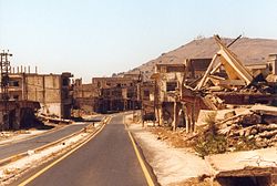
 View of the destroyed city | |
| Coordinates: 33°07′32″N 35°49′26″E / 33.12556°N 35.82389°E | |
| Country | Syria |
| Governorate | Quneitra |
| District | Quneitra |
| Subdistrict | Quneitra |
| Region | Golan Heights |
| Settled | around 1000 CE |
| Resettled | 1873 |
| Destroyed | 1974 |
| Government | |
| • Governor | Ahmad Sheikh Abdul-Qader |
| Elevation | 1,010 m (3,313 ft) |
| Population (2004 census[2]) | |
| • City | 153 |
| • Metro | 4,318 |
| Demonym(s) | Arabic: قنيطراوي, Qunayṭrawi or Qunayṭirawi |
| Time zone | UTC+2 (EET) |
| • Summer (DST) | UTC+3 (EEST) |
| Area code | 43 |
| Website | eQunaytra |
Quneitra (also Al Qunaytirah, Qunaitira, or Kuneitra; Arabic: ٱلْقُنَيْطِرَة or ٱلْقُنَيطْرَة, al-Qunayṭrah or al-Qunayṭirah ararar) is the abandoned capital of the Quneitra Governorate in south-western Syria.
Political status
[change | change source]
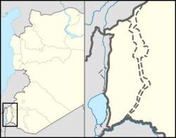
Quneitra is the capital of the Quneitra Governorate, a district of southwestern Syria that incorporates the whole of the Golan Heights. The city of Quneitra is within the portion of the Golan Heights controlled by Syria. Madinat al-Baath (Baath City) became the new capital.[3]
Yom Kippur War
[change | change source]-
Golan Heights campaign during Yom Kippur War
-
Destroyed building in Quneitra
-
The entrance to the city
-
Quneitra hospital. The sign reads: "Golan Hospital. Destructed by Zionists and changed it to firing target!" [sic]
References
[change | change source]- ↑ Geoffrey William Bromiley. "Golan", in International Standard Bible Encyclopedia: E-J, p. 520. Wm. B. Eerdmans Publishing, 1994. ISBN 0-8028-3782-4
- ↑ Quneitra city population Archived 2013-01-22 at the Wayback Machine
- ↑ Al-Khalidi, Suleiman (20 November 2014). "Syrian insurgents attack government-held town near Israel". Reuters. Archived from the original on 7 May 2015. Retrieved 18 June 2015.
Other websites
[change | change source]


![Quneitra hospital. The sign reads: "Golan Hospital. Destructed by Zionists and changed it to firing target!" [sic]](/media/wikipedia/commons/thumb/f/f0/Golan_Hospital.jpeg/120px-Golan_Hospital.jpeg)