Restrepo, Meta
Appearance
This article needs additional citations for verification. (January 2021) |
Restrepo, Meta | |
|---|---|
Municipality and town | |
 | |
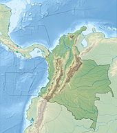
 Location of the municipality and town of Restrepo, Meta in the Meta Department of Colombia. | |
| Country | |
| Department | Meta Department |
| Area | |
• Total | 289 km2 (112 sq mi) |
| Elevation | 570 m (1,870 ft) |
| Population (Census 2018[2]) | |
• Total | 17,610 |
| • Density | 61/km2 (160/sq mi) |
| Time zone | UTC-5 (Colombia Standard Time) |
| Climate | Af |
Restrepo is a town and municipality in the Meta Department, Colombia.
Climate
[edit]Restrepo has a tropical rainforest climate (Köppen Af) with very heavy rainfall year round and extremely heavy rainfall from April to October. Precipitation exceeds 1,000 millimetres or 40 inches in May and June. It is the wettest place in the department of Meta, and one of the wettest places in the world, receiving comparable rainfall to the more famously wet Chocó region on the opposite side of the Andes.
| Climate data for Restrepo (Salinas de Upin), elevation 450 m (1,480 ft), (1971–2000) | |||||||||||||
|---|---|---|---|---|---|---|---|---|---|---|---|---|---|
| Month | Jan | Feb | Mar | Apr | May | Jun | Jul | Aug | Sep | Oct | Nov | Dec | Year |
| Mean daily maximum °C (°F) | 29.2 (84.6) |
29.1 (84.4) |
28.7 (83.7) |
28.1 (82.6) |
27.5 (81.5) |
26.2 (79.2) |
26.5 (79.7) |
27.2 (81.0) |
28.0 (82.4) |
28.0 (82.4) |
27.9 (82.2) |
28.3 (82.9) |
27.9 (82.2) |
| Daily mean °C (°F) | 24.3 (75.7) |
25.0 (77.0) |
24.5 (76.1) |
23.5 (74.3) |
23.0 (73.4) |
22.2 (72.0) |
21.9 (71.4) |
22.4 (72.3) |
22.8 (73.0) |
23.1 (73.6) |
23.2 (73.8) |
23.4 (74.1) |
23.3 (73.9) |
| Mean daily minimum °C (°F) | 20.8 (69.4) |
21.8 (71.2) |
21.1 (70.0) |
20.3 (68.5) |
20.0 (68.0) |
19.3 (66.7) |
19.0 (66.2) |
19.4 (66.9) |
19.3 (66.7) |
19.4 (66.9) |
20.1 (68.2) |
20.2 (68.4) |
20.1 (68.2) |
| Average precipitation mm (inches) | 60.5 (2.38) |
113.0 (4.45) |
207.4 (8.17) |
544.4 (21.43) |
667.3 (26.27) |
627.1 (24.69) |
544.7 (21.44) |
499.8 (19.68) |
413.5 (16.28) |
535.0 (21.06) |
407.5 (16.04) |
184.7 (7.27) |
4,804.9 (189.17) |
| Average precipitation days | 9 | 10 | 17 | 24 | 27 | 27 | 26 | 24 | 22 | 23 | 22 | 15 | 247 |
| Average relative humidity (%) | 76 | 74 | 78 | 85 | 88 | 90 | 88 | 87 | 86 | 86 | 86 | 84 | 84 |
| Mean monthly sunshine hours | 114.7 | 98.9 | 71.3 | 75.0 | 89.9 | 69.0 | 80.6 | 108.5 | 117.0 | 120.9 | 105.0 | 111.6 | 1,162.4 |
| Mean daily sunshine hours | 3.7 | 3.5 | 2.3 | 2.5 | 2.9 | 2.3 | 2.6 | 3.5 | 3.9 | 3.9 | 3.5 | 3.6 | 3.2 |
| Source: Instituto de Hidrologia Meteorologia y Estudios Ambientales[3] | |||||||||||||
References
[edit]- ^ "Municipalities of Colombia". statoids. Retrieved 7 May 2020.
- ^ "Censo Nacional de Población y Vivienda 2018" (in Spanish). DANE. Retrieved 7 May 2020.
- ^ "Promedios Climatológicos 1971–2000" (in Spanish). Instituto de Hidrologia Meteorologia y Estudios Ambientales. Retrieved 25 June 2024.[dead link]
4°15′00″N 73°34′00″W / 4.25°N 73.5667°W


