Siuna Airport
Appearance
Siuna Airport | |||||||||||
|---|---|---|---|---|---|---|---|---|---|---|---|
 | |||||||||||
| Summary | |||||||||||
| Airport type | Private | ||||||||||
| Operator | Republic of Nicaragua | ||||||||||
| Serves | Siuna, Nicaragua | ||||||||||
| Elevation AMSL | 606 ft / 185 m | ||||||||||
| Coordinates | 13°43′50″N 84°46′40″W / 13.73056°N 84.77778°W | ||||||||||
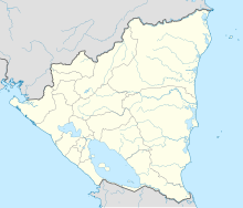
| Map | |||||||||||
 | |||||||||||
| Runways | |||||||||||
| |||||||||||
Siuna Airport (IATA: SIU, ICAO: MNSI) is an airport serving Siuna, Nicaragua. The airport is in the southern part of the town.
The runway runs uphill to the north, with an elevation change of 130 feet (40 m). There are nearby hills to the north and east.[4]
See also
[edit]References
[edit]- ^ Airport information for Siuna Airport at Great Circle Mapper.
- ^ Google Maps - Siuna
- ^ "Siuna Airport". SkyVector. Retrieved 8 January 2019.
- ^ Google Earth (elev)
External links
[edit]- OurAirports - Siuna
- OpenStreetMap - Siuna
- FallingRain - Siuna Airport
- Accident history for Siuna Airport at Aviation Safety Network

