Thimphu
The "Scots" that wis uised in this airticle wis written bi a body that haesna a guid grip on the leid. Please mak this airticle mair better gin ye can. |
Thimphu | ||||||
|---|---|---|---|---|---|---|
Frae upper left: Tashichho Dzong, Naitional Leebrar o Bhutan, an aerial view o Thimphu, View o Clock Tour Square | ||||||
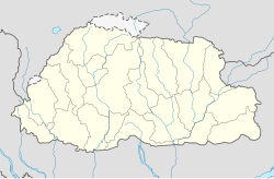
Location o Thimphu in Bhutan | ||||||
| Coordinates: 27°28′20″N 89°38′10″E / 27.47222°N 89.63611°ECoordinates: 27°28′20″N 89°38′10″E / 27.47222°N 89.63611°E | ||||||
| Kintra | ||||||
| Destrict | Thimphu Destrict | |||||
| Gewog | Chang Gewog | |||||
| Thromde | Thimphu | |||||
| Established as caipital | 1955 | |||||
| Tounship | 1961 | |||||
| Municipality | 2009 | |||||
| Govrenment | ||||||
| • Druk Gyalpo | Jigme Khesar Namgyel Wangchuck | |||||
| • Thrompon | Kinlay Dorjee | |||||
| Area | ||||||
| • Total | 26.1 km2 (10.1 sq mi) | |||||
| Elevation | 2320 m (7656 ft) | |||||
| Population (2015) | ||||||
| • Total | 104,000 | |||||
| • Density | 4000/km2 (10,000/sq mi) | |||||
| Time zone | UTC+6 (BTT) | |||||
| Area code(s) | +975-2 | |||||
| Climate | Cwb | |||||
| Website | thimphucity.bt | |||||
Thimphu (Tibetan alphabet: ཐིམ་ཕུག།, Dzongkha: ཐིམ་ཕུ), spelt Thimpu an aw, is the caipital an lairgest ceety o Bhutan.[1][2] It is situatit in the wastren central pairt o Bhutan an the name o the surroondin valley is dzongkhag, the Thimphu Destrict. The ceety became the caipital o Bhutan in 1961. In 2005 it haed a population o 79,185,[1] wi 98,676 fowk livin in the entire Thimphu destrict.
The ceety is spread oot longitudinally in a north-sooth direction on the wast bank o the valley formed bi the Wang Chuu, kent as the Thimphu Chuu River an aw. Thimphu is locatit at 27°28′00″N 89°38′30″E / 27.46667°N 89.64167°E an is spread ower an altitudinal range atween 2,248 metres (7,375 ft) an metres (8,688 ft).[3][4][5][6][7] Unuisually for a caipital ceety, Thimphu is no served bi an airport, but relies on the airport at Paro, connectit bi road some 54 kilometres (34 mi) away.
Thimphu, as the poleetical an economic centre o Bhutan, haes a dominant agricultural an livestock base, which contributes tae 45% o the kintra's GNP.[8] Tourism, tho a contributor tae the economy, is strictly regulatit, maintainin a balance atween the traditional an development an modrenization. Thimphu contains maist o the important poleetical biggins in Bhutan, includin the Naitional Assembly o the newly formed parliamentary democracy an Dechencholing Palace, the offeecial residence o the Keeng, locatit tae the north o the ceety. As a metroplis an caipital ceety, Thimphu is coordinatit bi the "Thimphu Structure Plan", an Urban Development Plan which evolved in 1998 wi the objective o protectin the fragile ecology o the valley. This development is ongoin wi financial assistance frae the World Bank an Asian Development Bank.
The cultur o Bhutan is fully reflectit in Thimphu in respect o literature, releegion, customs, an naitional dress code, the monastic practices o the monasteries, muisic, dance, literature an in the media. Tsechu festival is an important festival when mask dances, popularly kent as Cham dances, are performed in the courtyards o the Tashichhoe Dzong in Thimphu. It is a fower day festival held ivery year durin Hairst (September/October), on dates correspondin tae the Bhutanese calendar.
References
[eedit | eedit soorce]- ↑ a b "Thimphu". Encyclopædia Britannica. Retrieved 5 Juin 2010.
- ↑ Parekh, N (1986). Himalayan memoirs. Popular Prakashan. p. 67.
- ↑ "Thimpu Dzongkhag". Government of Bhutan. Archived frae the original on 8 September 2010. Retrieved 8 Juin 2010.
- ↑ "Bhutan". Tourism Council of Bhutan:Government of Bhutan. Archived frae the original on 9 Apryle 2018. Retrieved 7 Juin 2010.
- ↑ "Introduction: Understanding Natural Systems". Government of Bhutan. Archived frae the original on 3 December 2012. Retrieved 7 Juin 2010.
- ↑ Brown, p. 97
- ↑ Palin, p. 245
- ↑ "Economy". Tourism Government of Bhutan. Archived frae the original on 14 Juin 2014. Retrieved 15 Januar 2011.
| Wikimedia Commons haes media relatit tae Thimphu. |
| This Asie-relatit airticle is a stub. Ye can help Wikipaedia bi expandin it. |
| This ceity-relatit airticle is a stub. Ye can help Wikipaedia bi expandin it. |


