User:Lekhagau154/sandbox
| Annapurna North Base camp | |
|---|---|
 | |
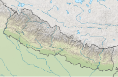
| Location | Narchyang, Nepal |
| Coordinates | 28°38′35″N 83°47′02″E / 28.643°N 83.784°E |
| Type | Traking Routes |
| Total height | 1400 m to 4190 m |
Annapurna North Base Camp lies along the Annapurna trekking trail, | accessdate = 2022-10-30| date = 2017-03-31| Annapurna Rural Municipality in Myagdi district.[1]
Annnapurna North Base Camp (ANBC)as seen during Autumn Season This route was explored in 2019 by the Annapurna Rural Municipality (ARM) Group. Different trekking association of nepali like of association of nepal like Trekking Agenciess Association of nepal(TAAN), Annpurna COnservation Area project(ACAP)and Ministry of tourism is Making an effort to bring this route among different groups,travel agencies, individual trekker for the promotion of this historic trek route.
Short History of the Annapurna North Base Camp
On june3,1950,an expedition team led by maurice Herzog became the first climbers to reach the top of Mount Annapurna. It was also the first time
that climber had reached the top of an 8000-meterpeak. As a result of this history, the trail to Annapuna North Base Camp is also Known as the Maurice Harxog trail.Altenatively, it is also called the French North Face route. after french group conquerd the summit of Mount Annapuna i for the first time in the world where they also explored the North Face of Annapurna.
The trail remains one of the least crowded trails, owing to its difficult path. There are no facilities of accommodation in many areas of the trail and so trekkers have to camp on the way for overnight stay.What makes Annapurna North base Camp intresting although it is a moderately challenging trek it has an immenens natural beauty of the Himalayas.The trail and the camp offer some mesmerizing views of high Mountains such as Annapuna I MountNilgiri, and Dhaulagiri.The path goes through dense green forest, waterfalls,caves and glaciers.the area is rich biodiversity, flora and fauna. Wild livessuch such as musk deer, Snow leapards,bears,wild dogs,and blue sheep can be seen on the way.rays of sun hitting the North Annapuna Base Camp.
Annapurna North Base Camp Trekking ltinerary Day 01:Drive Pokhara to Tatopani through beni(6-7hrs)and lowerNarchyang by road overnight. Day 02: LowerNarchyang (besigau) Chhotepa 2370 m (5-6 hrs) by vehicle off road.(Camping) Day 03:Chhotepa to Sandhikharka (6-7 hrs)through Humkhola . Overnight at sandhikharka 3160 m (Camping) Day 04:sandhikharka to Annapurna North Base camp(7-8 hrs)through Bhusket Mela. Overnight at 4068m. (Camping) Day 05:Explore North Annapurna Base cam glaciers(4190m)and trek to sandhikharka(7-8 hrs) Overnigh at Sandikharka 3160m. (Camping) Day 06:trek Sandhikharka to Lower Narchyang through Humkhola - Chhotepa(7-8 hrs)trek, then off -road drive down to Lower Narchyang . and Tatopani. Day 07: A short trek to Tatopani and Drive back to Pokhara. (6-7 hrs)
References=
[edit][https://travelnepal.com/nepal-stories/another-way-to-annapurna-narchyang-and-the-herzog-trail/ https://northnepaltrek.com/annapurna-north-base-camp-trek/</ref> .[2]
- ^ "A beautiful waterfall at the top of Narchyang Village (Photo Feature)". Retrieved 2020-12-17.
- ^ "गाउँको सुन्दरता बढाउँदै नारच्याङ झरना". Retrieved 2020-12-17.

