User:Theanphibian/conversion tool
This is the user page of my foreign Infobox conversion tool. Format:
==[[Dam page]]==
- English Japan dam template
- Raw template from other language Wikipedia
Process:
- Copy the wikicode for the desired infobox into new section for the article you want but replace the template name with User:Theanphibian/a.
- Preview this page. Copy the text produced by the /a template and paste it at the beginning of your section and (after tidying up) save this page.
- You're done, copy the wikicode to your article.
| |||||||||||||||||||||||||||||||||||||||||||||||||||||||||||||||||||||
{{User:Theanphibian/new version
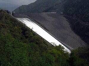
| picture = image:Tokuyama-958-r1.JPG
| address = Left side:Ibigawa, Gifu, Higashisuibara
Right side:Ibigawa, Gifu Higashisuibara
| coordinate = 35°39′55″N 136°30′08″E / 35.66528°N 136.50222°E
| rivers = Kiso River-Ibi River
| lake = To be named
| type = Rock fill dam
<!-- Numbers -->
| height = 161.0
| length = 427.1
| dam_volume = 13,700,000
| capacity_volume = 660,000,000
| storage_volume = 380,400,000
| catchment_area = 254.5
| inundation_area = 1,300.0
| utilization = Flood Control・Irrigation
Waterworks・Industry・Power
| owner = EPDC
→Ministry of Construction
Chubu Office
→Japan Water Agency
| utility = EPDC
→Chubu Electric
| generators = Tokuyama generator
(153,000kW)
| construction = Kumagai Gumi
Taisei Corporation
Asunaro Aoki Construction
| started = 1971
| finished = 2008
| notes = 350 billion yen total cost
}}
| |||||||||||||||||||||||||||||||||||||||||||||||||||||||||||||||||||||
{{User:Theanphibian/new version
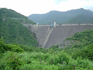
| picture = image:Miyama-568-r1.jpg
| address = 左岸:栃木県那須塩原市百村字深山
右岸:栃木県那須塩原市百村字深山
| coordinate = 37°05′21″N 139°54′16″E / 37.08917°N 139.90444°E
| rivers = 那珂川水系那珂川
| lake = 深山湖
| type = アスファルトフェイシングフィルダム
<!-- Numbers -->
| height = 75.5
| length = 333.8
| dam_volume = 1,967,000
| capacity_volume = 25,800,000
| storage_volume = 20,900,000
| catchment_area = 66.4
| inundation_area = 97.0
| utilization = 灌漑・上水道・発電
| owner = 農林省関東農政局
→栃木県
| utility = 電源開発
(沼原発電所)
栃木県企業局
(板室発電所)
| generators = 沼原発電所
(675,000kW)
板室発電所
(16,100kW)
| construction = 大林組
| started = 1968年
| finished = 1973年
| notes =
}}
| |||||||||||||||||||||||||||||||||||||||||||||||||||||||||||||||||||||
{{User:Theanphibian/new version
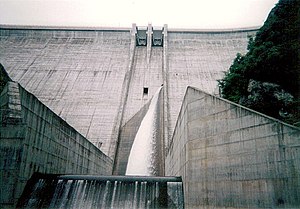
| picture = [[image:Okutadamidam-0A3N80pbxFs6g.JPG|300px|Okutadami dam]]
| address = 左岸:新潟県魚沼市湯之谷芋川
右岸:福島県南会津郡桧枝岐村駒嶽
| coordinate = 37°09′13.2″N 139°15′00.3″E / 37.153667°N 139.250083°E
| rivers = 阿賀野川水系只見川
| lake = 奥只見湖
(ダム湖百選)
| type = 重力式コンクリートダム
<!-- Numbers -->
| height = 157.0
| length = 480.0
| dam_volume = 1,636,000
| capacity_volume = 601,000,000
| storage_volume = 458,000,000
| catchment_area = 595.1
| inundation_area = 1,150.0
| utilization = 発電
| owner = 電源開発
| utility = 電源開発
| generators = 奥只見発電所
(560,000kW)
奥只見(維持流量)発電所
(2,700kW)
| construction = 鹿島建設
| started = 1953
| finished = 1960
| notes =
}}
| |||||||||||||||||||||||||||||||||||||||||||||||||||||||||||||||||||||
{{User:Theanphibian/new version
| picture = [[image:Minamiaiki Dam.jpg|center|300px|南相木ダム]]
| address = 長野県南佐久郡南相木村南相木国有林地先
| coordinate = 36°00′16″N 138°39′13″E / 36.00444°N 138.65361°E
| rivers = 信濃川水系相木川左支
南相木川(三川)
| lake = 奥三川湖
| type = 中央土質遮水壁型
ロックフィルダム
<!-- Numbers -->
| height = 136.0
| length = 444.0
| dam_volume = 7,300,000
| capacity_volume = 19,170,000
| storage_volume = 12,670,000
| catchment_area = 6.2
| inundation_area = 59.0
| utilization = 発電
| owner = 東京電力
| utility = 東京電力
| generators = 神流川発電所
(2,820,000kW:予定)
| construction = 前田建設工業
大成建設
大林組
青木あすなろ建設
| started = 1995年
| finished = 2005年
| notes =
}}
| |||||||||||||||||||||||||||||||||||||||||||||||||||||||||||||||||||||
{{User:Theanphibian/new version
| picture = [[image:Ueno-3281-r1.jpg|300px|上野ダム]]
| address = 左岸:群馬県多野郡上野村大字楢原字本谷
右岸:群馬県多野郡上野村大字楢原字本谷
| coordinate = 36°03′11″N 138°42′16″E / 36.05306°N 138.70444°E
| rivers = 利根川水系烏川右支神流川
| lake = 奥神流湖
| type = 重力式コンクリートダム
<!-- Numbers -->
| height = 120.0
| length = 350.0
| dam_volume = 720,000
| capacity_volume = 18,400,000
| storage_volume = 12,670,000
| catchment_area = 31.2
| inundation_area = 56.0
| utilization = 発電
| owner = 東京電力
| utility = 東京電力
| generators = 神流川発電所
(2,820,000kW:予定)
| construction = ハザマ・飛島建設・
日本国土開発・戸田建設
| started = 1995年
| finished = 2005年
| notes =
}}


