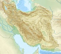
Warwasi
Appearance
| Location | north of Kermanshah |
|---|---|
| Region | Iran |
| Coordinates | 34°27′34″N 47°6′18″E / 34.45944°N 47.10500°E |
| History | |
| Periods | from Middle Paleolithic to late Epipaleolithic |
Warwasi is a Paleolithic rockshelter site located at north of Kermanshah in western Iran. It was excavated by Bruce Howe under direction of late Robert Braidwood in the 1960s. This site contains a rich archaeological sequence from Middle Paleolithic to late Epipaleolithic.
References
[edit]- Braidwood, R. J. (1960) Seeking the World's First Farmers in Persian Kurdistan: A Full-Scale Investigation of Prehistoric Sites Near Kermanshah. The Illustrated London News no. 237, pp. 695–97.
- Dibble, H.L., & S.J. Holdaway (1993). The Middle Paleolithic Industries of Warwasi. In The Paleolithic Prehistory of the Zagros-Taurus, edited by D.I. Olszewsky and H.L. Dibble, pp. 75–99. Philadelphia: University Museum Symposium Series, Volume 5, University of Pennsylvania.
- Olszewski, D.I. (1993). The Late Baradostian Occupation at Warawsi Rockshelter, Iran. In The Paleolithic Prehistory of the Zagros-Taurus, edited by D.I. Olszewsky and H.L. Dibble, pp. 187–206. Philadelphia: University Museum Symposium Series, Volume 5, University of Pennsylvania.
- Olszewski, D.I. (1993). The Zarzian Occupation at Warwasi Rockshelter, Iran. In The Paleolithic Prehistory of the Zagros-Taurus, edited by D.I. Olszewsky and H.L. Dibble, pp. 207–236. Philadelphia: University Museum Symposium Series, Volume 5, University of Pennsylvania.
- Shidrang, S. (2018). The Middle to Upper Paleolithic transition in the Zagros: the appearance and evolution of the Baradostian. In The Middle and Upper Paleolithic Archeology of the Levant and Beyond (pp. 133-156). Springer, Singapore.

