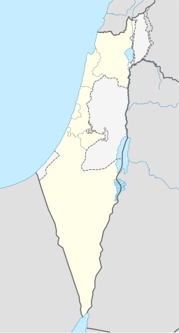
Artas i Betlehem
| Artas | |||
| أرطاس | |||
| kommune | |||
Hortus Conclusus-klosteret i Artas
| |||
| Namneopphav: Urtas, etternamn[1] | |||
| Land | |||
|---|---|---|---|
| Guvernement | Betlehem guvernement | ||
| Koordinatar | 31°41′21″N 35°11′10″E / 31.68917°N 35.18611°E | ||
| Areal | 4,3 km² | ||
| Folketal | 3 663 (2007) | ||
| Folketettleik | 852 / km² | ||
 Artas i Betlehem 31°41′21″N 35°11′10″E / 31.689166666667°N 35.186111111111°E | |||
| Wikimedia Commons: Artas | |||
Artas (arabisk أرطاس) er ein palestinsk landsby fire kilometer sørvest for Betlehem i Betlehem guvernement, sentralt på Vestbreidda. I følgje Palestinsk statistisk sentralbyrå hadde byen eit folketal på 3 663 i 2007.[2]
Historie
[endre | endre wikiteksten]
Landsbyen vart ein del av Det osmanske riket i 1517 i lag med resten av Palestina, og i 1596 stod han oppført i skattelister som ein del av Quds nahiya i Quds liwa. Han hadde eit folketal på 32 muslimske hushaldningar.[3]
Fram til 1800-talet, hadde innbyggjarane i Artas ansvar for Salomodammane, ei tunikt vassystem som gav vatn til Betlehem og Herodium og Tempelhøgda eller Haram al-Sharif i Jerusalem.[4]
Den franske oppdagaren Victor Guérin vitja området i juli 1863,[5] og han estimerte at landsbyen hadde kring 300 innbyggjarar. Mange av husa i landsbyen var bygde av gamle byggemateriale.[6]
I 1883 skildra Palestine Exploration Fund landsbyen i Survey of Western Palestine som «ein liten landsby høgt oppe i ei li, med gode kjelder bak.»[7]
Det britiske mandatet
[endre | endre wikiteksten]I folketeljinga i 1922, utført av Dei britiske mandatstyresmaktene, hadde Urtas eit folketal på 433, dei fleste muslimar, medan 44 var kristne.[8] I folketeljinga i 1931 var folketalet i Artas 619 i 123 busette hus.[9]
I 1945 auka folketalet i Artas til 800, alle arabarar, som eigde 4 304 dekar land i følgje ei offisiell landmåling.[10] Av dette var 894 dekar var plantasjar og irrigert land, 644 for korn,[11] medan 54 dekar vart utbygd (urbant) land.[12]
Kjelder
[endre | endre wikiteksten]- ↑ Palmer, 1881, s. 330
- ↑ 2007 PCBS Census Palestinsk statistisk sentralbyrå. s.118.
- ↑ Hütteroth and Abdulfattah, 1977, s. 116
- ↑ A Century and a Half of Women's Encounters in Artas
- ↑ Guérin, 1869, s. 104 ff
- ↑ Guérin, 1869, s. 108
- ↑ Conder og Kitchener, 1883, Vol III, 'Urtas'. s. 27.
- ↑ Barron, 1923, Table VII, Subdistrict of Betlehem, s. 18
- ↑ Mills, 1932, s. 35
- ↑ Government of Palestine, Department of Statistics. Village Statistics, April, 1945. Sitert i S. Hadawi, Village Statistics, 1945. PLO Research Sentral, 1970, s. 56
- ↑ Government of Palestine, Department of Statistics. Village Statistics, April, 1945. Sitert i S. Hadawi, Village Statistics, 1945. PLO Research Sentral, 1970, s. 101
- ↑ Government of Palestine, Department of Statistics. Village Statistics, April, 1945. Sitert i S. Hadawi, Village Statistics, 1945. PLO Research Sentral, 1970, s. 151
- Denne artikkelen bygger på «Artas, Betlehem» frå Wikipedia på engelsk, den 1. oktober 2015.
- Wikipedia på engelsk oppgav desse kjeldene:
- Barron, J. B., red. (1923). Palestine: Report and General Abstracts of the Census of 1922. Government of Palestine.
- Conder, Claude Reignier; Kitchener, Herbert H. (1883). The Survey of Western Palestine: Memoirs of the Topography, Orography, Hydrography, and Archeology 3. London: Committee of the Palestine Exploration Fund.
- Guérin, Victor (1869). Description Géographique Historique et Archéologique de la Palestine (på fransk). 1: Judee, pt. 3. Paris: L'Imprimerie Nationale.
- Hadawi, Sami (1970). Village Statistics of 1945: A Classification of Land and Area ownership in Palestine. Palestinsk frigjeringsorganisasjon forskingssentral.
- Hütteroth, Wolf-Dieter; Abdulfattah, Kamal (1977). Historical Geography of Palestine, Transjordan and South Syria in the Late 16th Century. Erlanger Geographische Arbeiten, Sonderband 5. Erlangen, Tyskland: Vorstand der Fränkischen Geographischen Gesellschaft. ISBN 3-920405-41-2.
- E. Mills, red. (1932). Census of Palestine 1931. Population of Villages, Towns and Administrative Areas (PDF). Jerusalem: Government of Palestine.
- Palmer, E. H. (1881). The Survey of Western Palestine: Arabic and English Name Lists Collected During the Survey by Lieutenants Conder og Kitchener, R. E. Transliterated and Explained by E.H. Palmer. Committee of the Palestine Exploration Fund.
- F de Saulcy (1872): Voyage en terre sainte Vol 2.
- Rogers, Mary Eliza (1865). Domestic life in Palestina. Poe & Hichcock.
- Sharon, Moshe (1997). Corpus Inscriptionum Arabarum Palaestinae, Vol. I, A. BRILL. ISBN 90-04-10833-5.
- Socin, A. (1879). «Alphabetisches Verzeichniss von Ortschaften des Paschalik Jerusalem». Zeitschrift des Deutschen Palästina-Vereins 2: 135–163.
- le Strange, Guy (1890). Palestine Under the muslimar: A Description of Syria and the Holy Land from A.D. 650 to 1500. Committee of the Palestine Exploration Fund., London


