Burgsinn
Burgsinn | |
|---|---|
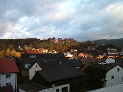
 View from the Mäusberg over Burgsinn | |
| Coordinates: 50°09′N 09°39′E / 50.150°N 9.650°E | |
| Country | Germany |
| State | Bavaria |
| Admin. region | Unterfranken |
| District | Main-Spessart |
| Municipal assoc. | Burgsinn |
| Government | |
| • Mayor (2020–26) | Robert Herold[1] |
| Area | |
| • Total | 51.38 km2 (19.84 sq mi) |
| Elevation | 190 m (620 ft) |
| Population (2022-12-31)[2] | |
| • Total | 2,333 |
| • Density | 45/km2 (120/sq mi) |
| Time zone | UTC+01:00 (CET) |
| • Summer (DST) | UTC+02:00 (CEST) |
| Postal codes | 97775 |
| Dialling codes | 09356 |
| Vehicle registration | MSP |
| Website | Municipal website |
Burgsinn is a market community in Main-Spessart in the Regierungsbezirk of Lower Franconia (Unterfranken) in Bavaria, Germany and the seat of the Verwaltungsgemeinschaft (municipal association) of Burgsinn. It has a population of around 2,500.
Geography
[change | change source]Location
[change | change source]Burgsinn is in Main-Spessart, in the Mittelgebirge Spessart. It is in the valley of the river Sinn from which it takes its name.
Subdivisions
[change | change source]The community has only the Gemarkung (traditional rural cadastral area) of Burgsinn. The municipal territory stretches into the wooded hills east and west of the Sinn valley.
Neighbouring communities
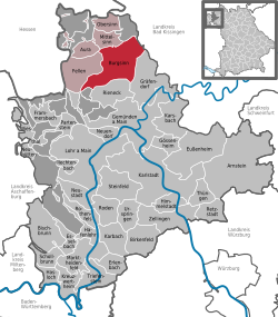
[change | change source]Burgsinn borders on (from the north, clockwise): Mittelsinn, the unincorporated areas Forst Aura and Omerz und Roter Berg, Wartmannsroth, Gräfendorf, Rieneck, Herrnwald (unincorporated area), Fellen and Aura im Sinngrund.
References
[change | change source]- ↑ Liste der ersten Bürgermeister/Oberbürgermeister in kreisangehörigen Gemeinden, Bayerisches Landesamt für Statistik, 15 July 2021.
- ↑ Genesis Online-Datenbank des Bayerischen Landesamtes für Statistik Tabelle 12411-003r Fortschreibung des Bevölkerungsstandes: Gemeinden, Stichtag (Einwohnerzahlen auf Grundlage des Zensus 2011) .


