Malá Morávka
Malá Morávka | |
|---|---|
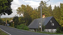
 Karlov pod Pradědem, a part of Malá Morávka | |
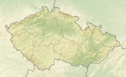
| Coordinates: 50°1′16″N 17°18′43″E / 50.02111°N 17.31194°E | |
| Country | |
| Region | Moravian-Silesian |
| District | Bruntál |
| First mentioned | 1598 |
| Area | |
• Total | 61.56 km2 (23.77 sq mi) |
| Elevation | 660 m (2,170 ft) |
| Population (2024-01-01)[1] | |
• Total | 658 |
| • Density | 11/km2 (28/sq mi) |
| Time zone | UTC+1 (CET) |
| • Summer (DST) | UTC+2 (CEST) |
| Postal code | 793 36 |
| Website | www |
Malá Morávka (German: Klein Mohrau) is a municipality and village in Bruntál District in the Moravian-Silesian Region of the Czech Republic. It has about 700 inhabitants.
Administrative parts
[edit]The village of Karlov pod Pradědem is an administrative part of Malá Morávka.
Geography
[edit]Malá Morávka is located about 11 kilometres (7 mi) west of Bruntál and 47 km (29 mi) north of Olomouc. It lies in the Hrubý Jeseník mountain range. The peaks of the three highest mountains of Hrubý Jeseník, including Praděd at 1,491 m (4,892 ft) above sea level, lie in the northwestern part of the municipal territory. The Moravice River and the stream Bělokamenný potok flows though the territory and join in the village.
History
[edit]From the 15th century, the area was owned by Lords of Vrbno and was known for mining of iron ore. A group of hammer mills was founded in the area of Malá Morávka in the second half of the 16th century. The first written mention of Malá Morávka is from 1598.[2]
Demographics
[edit]
|
|
| ||||||||||||||||||||||||||||||||||||||||||||||||||||||
| Source: Censuses[3][4] | ||||||||||||||||||||||||||||||||||||||||||||||||||||||||
Transport
[edit]Malá Morávka is the terminus of a short railway line from Bruntál. It operates only in the summer season.
Sights
[edit]
The main landmark of Malá Morávka is the Church of All Saints. It was built in the Neoclassical style in 1790–1793.[5]
For the well-preserved urbanism of a village typical of this region and for many high-quality examples of regional folk architecture, Malá Morávka is protected as a village monument zone.[6]
References
[edit]- ^ "Population of Municipalities – 1 January 2024". Czech Statistical Office. 2024-05-17.
- ^ "Malá Morávka" (in Czech). Obec Malá Morávka. Retrieved 2024-03-21.
- ^ "Historický lexikon obcí České republiky 1869–2011" (in Czech). Czech Statistical Office. 2015-12-21.
- ^ "Population Census 2021: Population by sex". Public Database. Czech Statistical Office. 2021-03-27.
- ^ "Kostel Nejsvětější Trojice" (in Czech). National Heritage Institute. Retrieved 2024-03-21.
- ^ "Malá Morávka" (in Czech). National Heritage Institute. Retrieved 2024-03-21.


